


At a Glance
This Lower Susquehanna day trip offers the chance to see some iconic area landmarks right from your kayak, including the rock face of Chickies Rock Overlook and the Veterans Memorial Bride in Columbia. You may take-out here for a half-day trip or continue into the wider waters of Lake Clarke and paddle amidst the protected birding area of the Conejohela Flats. Be prepared for headwinds and potential boat wakes as you near the final take-out.
Description
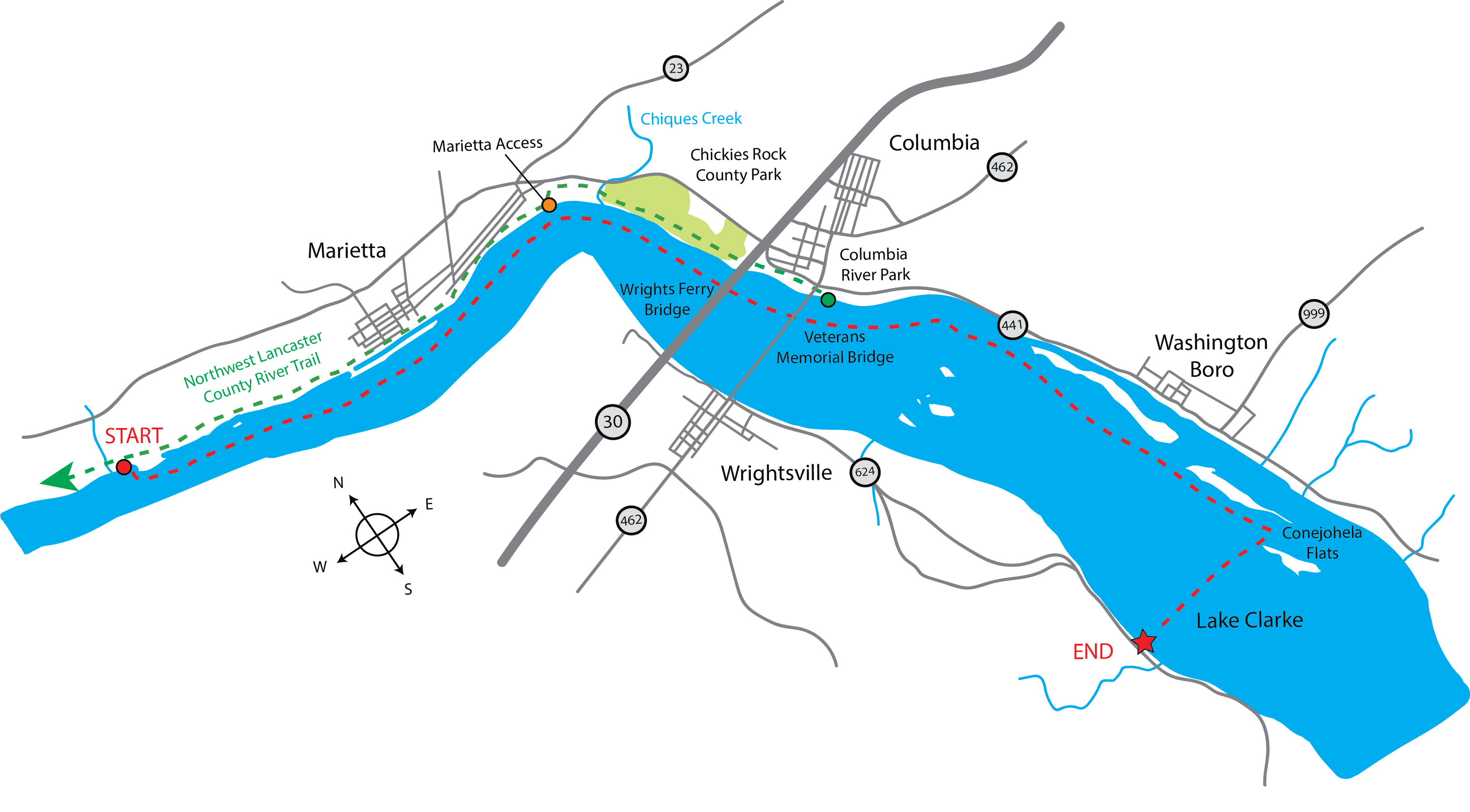
Your journey begins at the River Park access near the Rivertrail Pavilion in Marietta. The Northwest Lancaster County River Trail runs right by the pavilion and is a great way to bike to the towns of Marietta and Columbia after your trip if you are in the mood for a multi-modal experience.
The first few miles once putting into the river are a relatively calm and straightforward stretch. You will soon approach Marietta, which features numerous restaurants, lodging areas, trails, parks, and many other fun things to do. Chickies Rock County Park is a great place to visit after your paddle and can be accessed via the Northwest Lancaster County River Trail. The PFBC Marietta Access is also located near this park and is a good place to stop if needed.
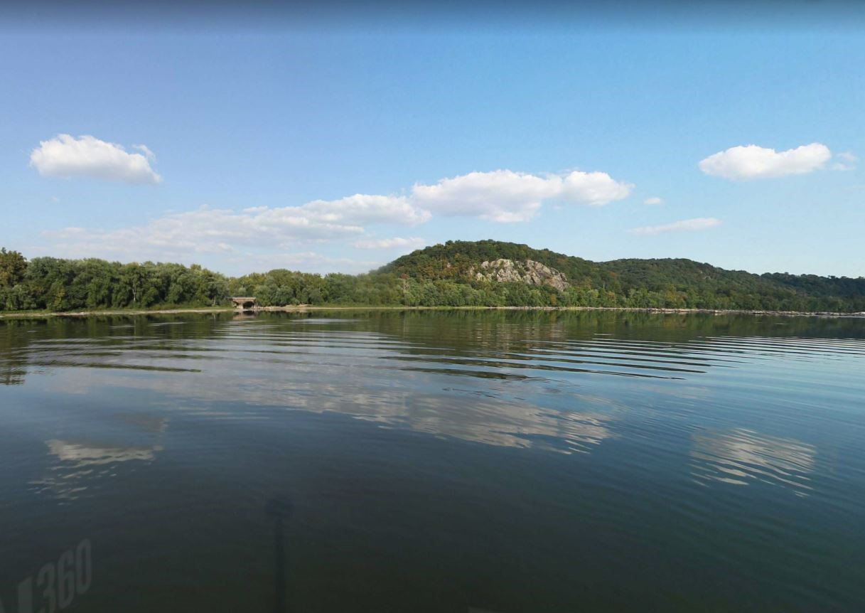
As you round the bend, you will pass the mouth of Chiques Creek on river left. Further downstream you can observe Chickies Rock, a rocky outcropping that looms over the Susquehanna River, also on river left. This outcropping can be access from land via the Chickies Rock Overlook Trail.
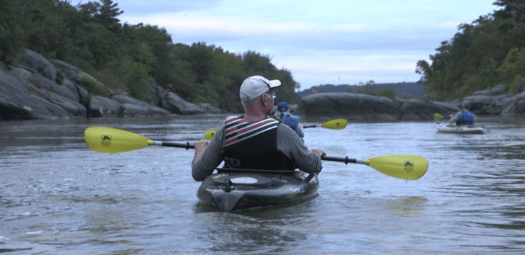
After paddling around the bend near RM 45, you will enter another relatively straight section, however, be aware of the numerous rocks, ledges, and riffles in the river. Run this section river right until you paddle past the US-30 bridge near Wrightsville. You may also encounter high winds while paddling this area. A few smaller private river islands are featured on this stretch, including Rosebud Island on river right.
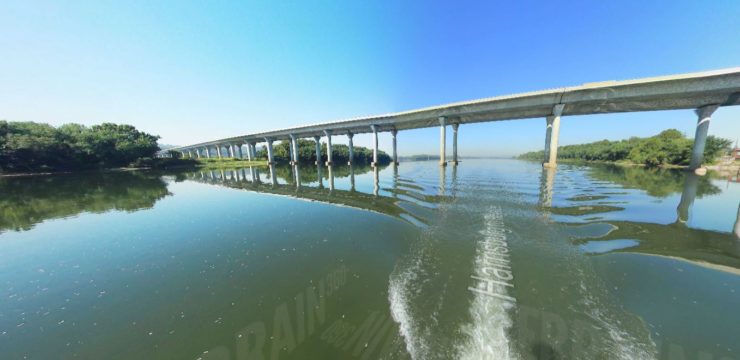
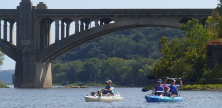
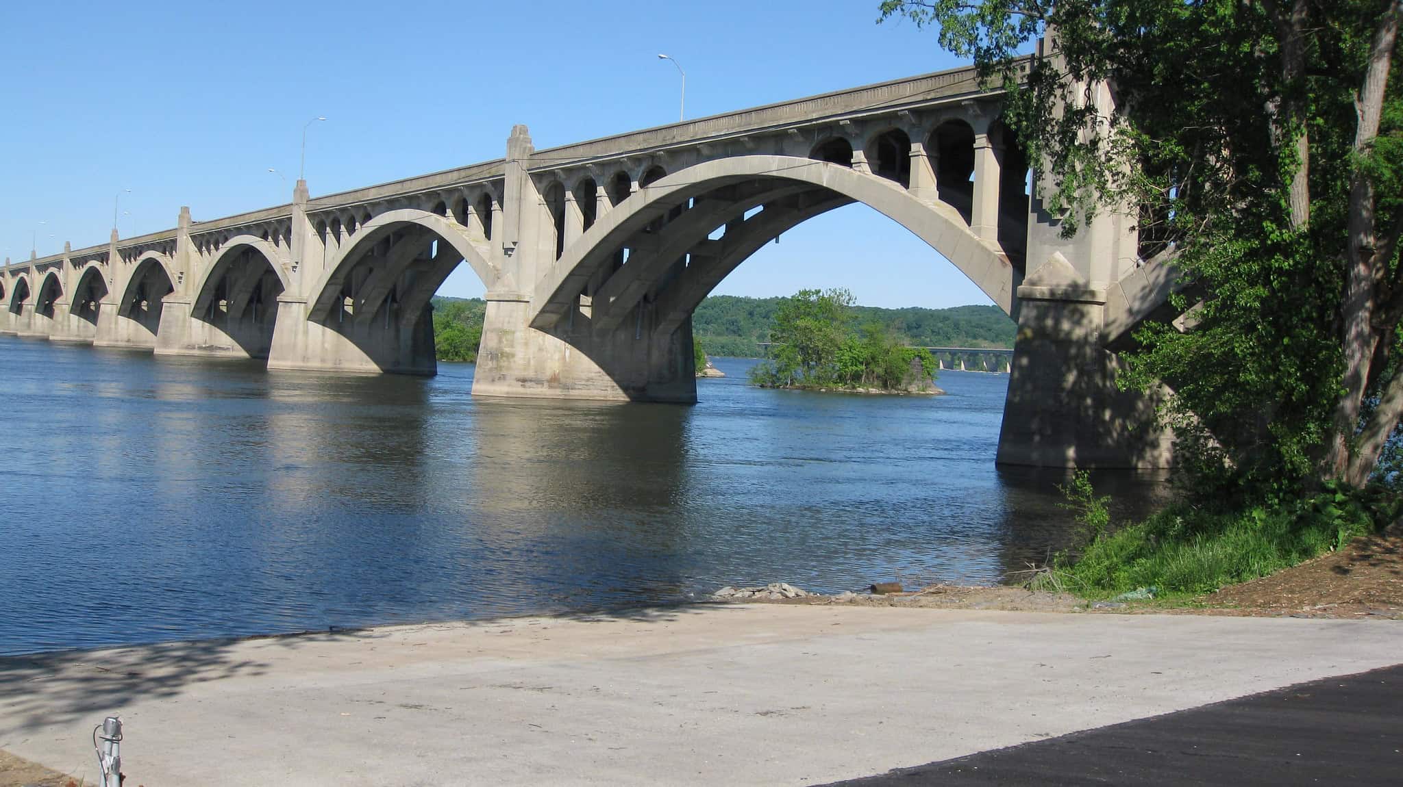
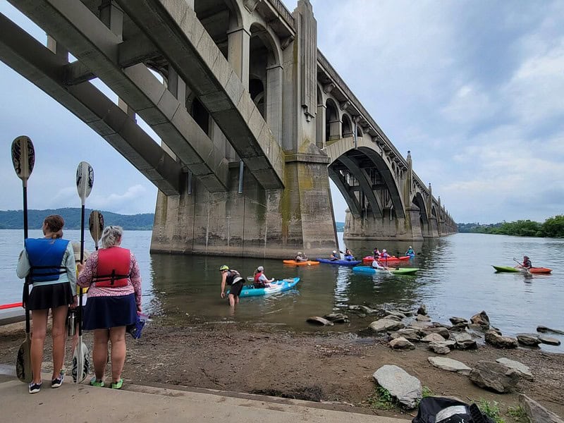
You will soon approach the Wrights Ferry Bridge, as well as the Veterans Memorial Bridge, which connects Columbia to Wrightsville. There are several parks you will see from the river near both Columbia and Wrightsville, including Columbia River Park (which is located next to the Columbia Crossing River Trails Center), the Wrightsville Commons Park, and Riverfront Park, near the Wrightsville World War 2 Memorial.
Beneath the bridge on river left, there is an alternative take-out point for those who seek a shorter paddle or plan to take a break for a picnic lunch, stretch, and access to restrooms. This is the PFBC Columbia Access.
For those who continue on downriver, you will come upon a cluster of islands with private boat docks. Be mindful of boat traffic as you navigate around these islands. After you pass these, paddle to the take-out on the waters of Lake Clarke. Be aware of some potential boating traffic in this stretch, as well as headwinds.

Photo by John Reitzel
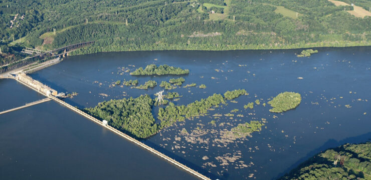
On the final leg of your paddle you will pass through the Conejohela Flats, a series of islands and mudflats that are designated as a National Birding Area by the National Audubon Society. These flats serve as a vital habitat for a variety of migrating shorebirds, waterfowl, and other birds including bald eagles and ospreys that can be observed while passing through. Paddlers are not permitted to take out on the islands.
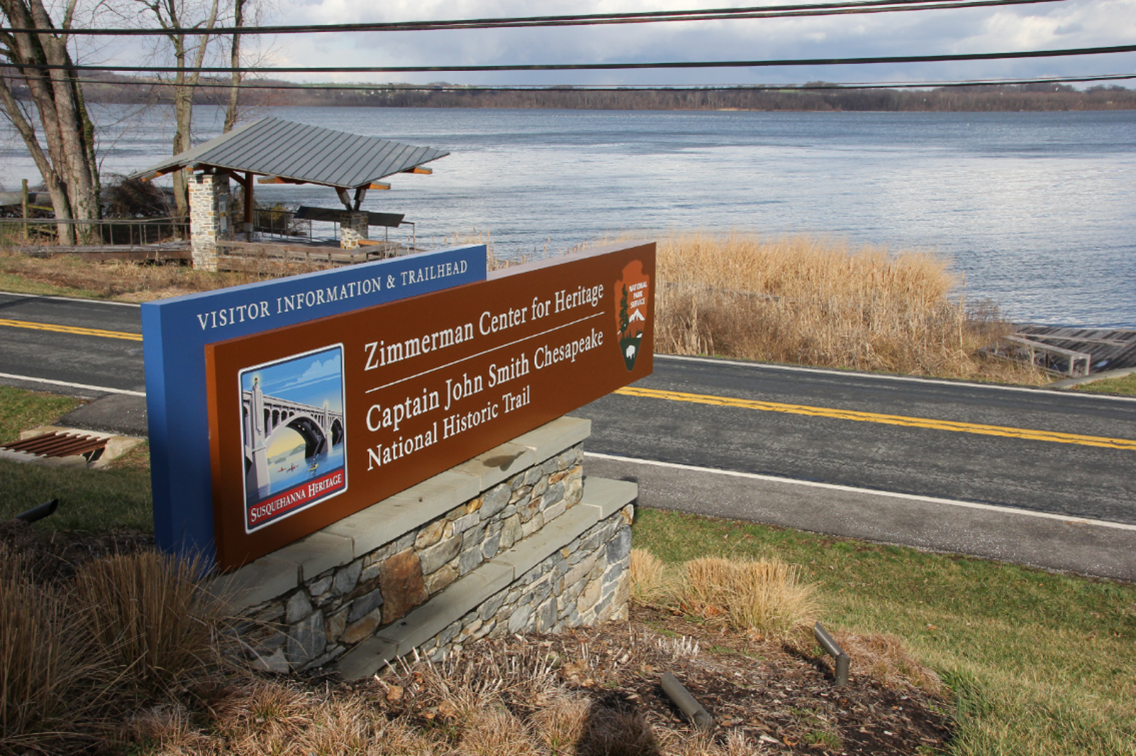
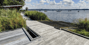
After exploring the islands, make sure to head towards river right and paddle towards the Zimmerman Center for Heritage canoe access. After taking out, head on over to the Zimmerman Center to learn about the river history, attend a Heritage lecture, or learn about the Captain John Smith Chesapeake National Historic Trail. You can also hop on the nearby Mason Dixon Trail, or head north to Klines Run Park and the Lake Clarke Marina.
Amenities
The River Park access has picnic pavilions, porta-potties, and a boat ramp. The Zimmerman Center for Heritage Access has a canoe access, with restroom and picnic facilities nearby at Klines Run Park (RM 39.6).
Put In
River Mile 49: River Park Access
Captured with Google Maps
Alternative Take Out / Lunch Stop
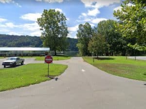
River Mile 42: PFBC Columbia Access
Take Out
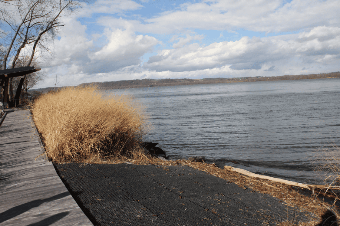
River Mile 39.1: Zimmerman Center for Heritage Access
Captured with Google Maps
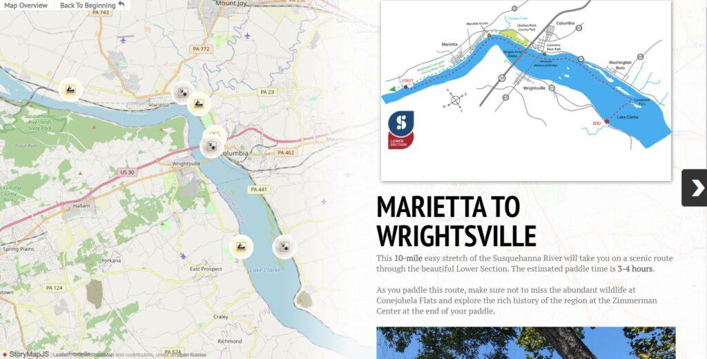
For Water Trail map, refer to: Susquehanna River Water Trail – Lower Section: Map 2
Explore the Route Virtually