Mission & Vision
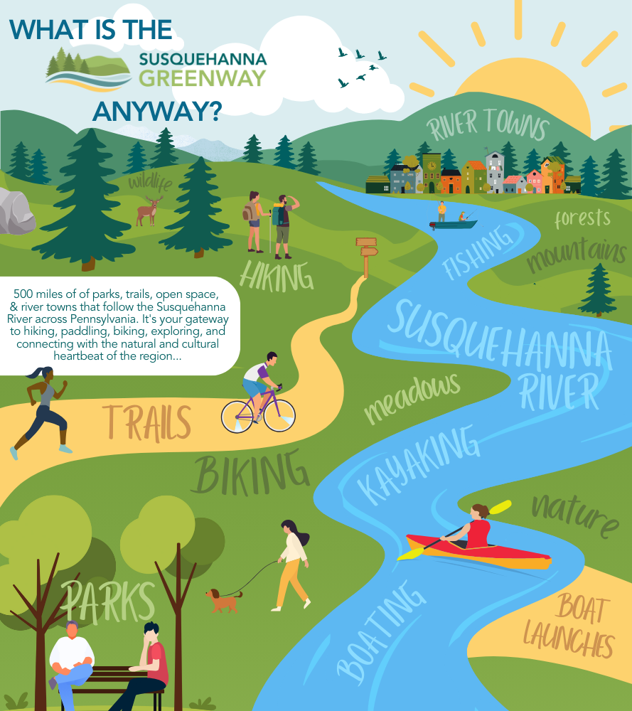
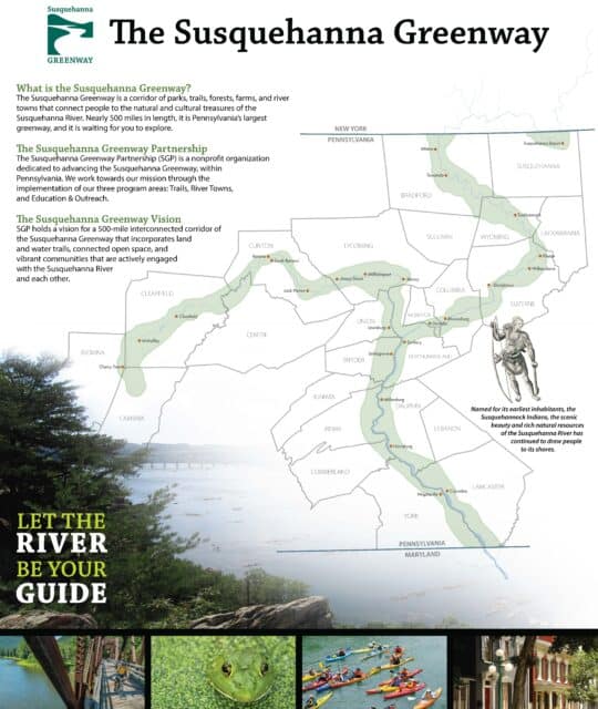
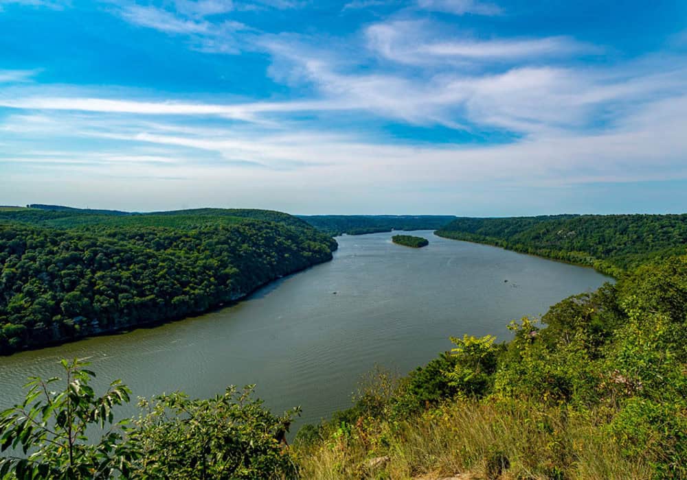
The Susquehanna Greenway is a connected corridor of trails, parks, conserved lands, river accesses, and communities that follows the Susquehanna River through Pennsylvania. Stretching for over 500 miles, it provides opportunities for outdoor recreation, including hiking, biking, and paddling, while linking people to the river’s natural beauty, cultural heritage, and vibrant river towns.
More than just a trail system, the Greenway is a dynamic resource that strengthens communities, improves physical and mental well-being, and fosters environmental stewardship. By enhancing outdoor access and encouraging active lifestyles, it contributes to healthier individuals and more engaged communities. It also serves as a pathway for exploration, offering insight into the river’s ecological importance, historical significance, and economic impact on the region.
Though the Susquehanna Greenway is not yet complete, the Susquehanna Greenway Partnership (SGP) is dedicated to its expansion and improvement. Through thoughtful planning, SGP is creating a lasting network that connects people to the river and ensures its benefits for future generations.
VISION:
We envision a vibrant Greenway that weaves together communities, trails, and natural spaces, transforming the Susquehanna River corridor into a place where adventure beckons, connections deepen, and the river’s beauty inspires.
MISSION:
Our mission is to work hand-in-hand with local, state, and national partners to complete the Susquehanna Greenway trail corridor and create resources that open the outdoors to everyone, ensuring all can experience the beauty and adventure of the Susquehanna River.
How do we work towards these goals?
- With the help of our many Partners, as well as individuals, governments, and local nonprofits
- Through the dedicated efforts of our Staff and Board of Directors
- By utilizing a collaborative approach and pursuing our three program areas: Trails, River Towns, and Education & Outreach
Trails
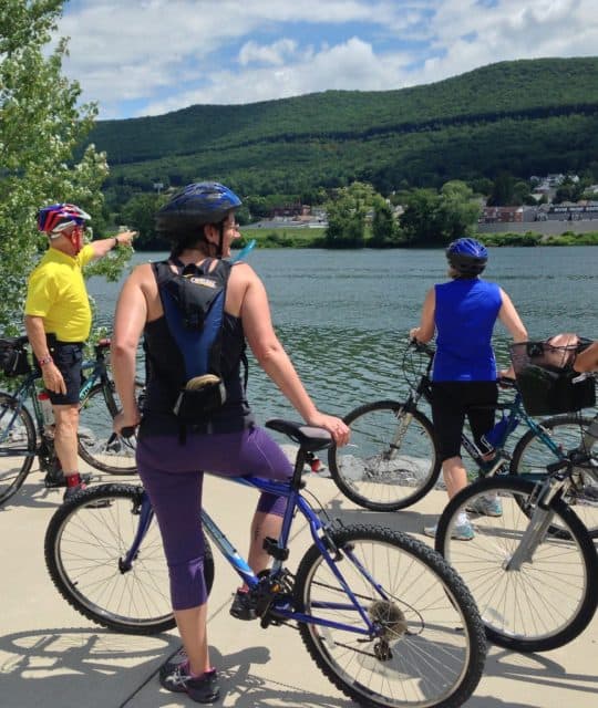
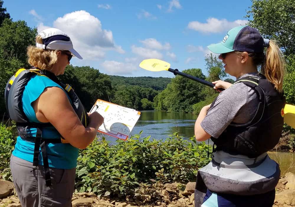
SGP serves as a resource for the many outdoor opportunities that exist within the greater Susquehanna Greenway corridor. Through this network, we want to make it possible for you to continuously walk, bike, or paddle from town to town along the 500-mile corridor of the Susquehanna Greenway.
SGP’s Trails Program helps communities and partners envision, build, and sustain trail segments within the Susquehanna Greenway that transform greenway corridors into vibrant public spaces that inspire active living.
By connecting communities and linking residents and visitors to the resources of the Susquehanna River with trails and greenways, we foster a positive association with the river, helping to build a greater sense of community, and providing healthy living opportunities.
SGP provides technical assistance and works collaboratively with our partners to:
- Link communities within the Susquehanna Greenway via greenways and trails
- Link riverfront parks to downtown businesses and residential areas to provide public access to the river and water trail
- Link local trail systems to other regional trail systems
- Link wildlife habitat corridors especially along riparian corridors
- Improve river access
- Preserve, enhance, and interpret scenic, historic, geologic, natural and cultural heritage assets and connect users to their enduring stories through signage and promotion
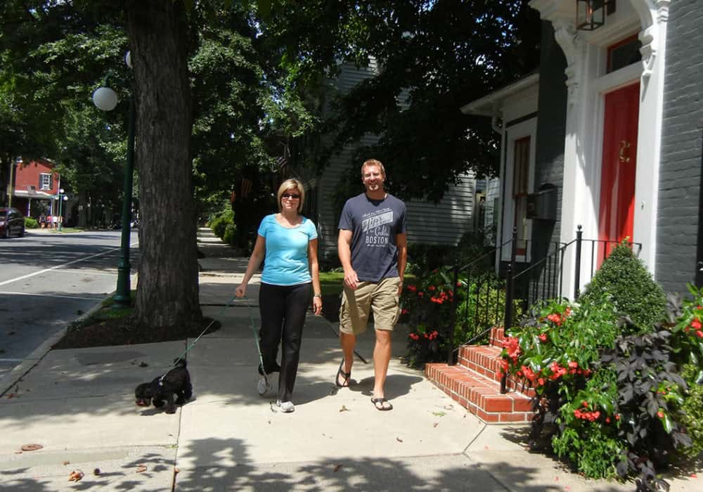
River Towns
SGP’s River Towns Program works with communities throughout the Susquehanna Greenway to envision, prioritize, and implement community-led projects that reconnect their residents to the Susquehanna River, create trails and boat launches, and interpret the community’s natural and cultural assets.
SGP’s experience and large network of public and private partners makes us uniquely qualified to lead communities toward the shared goal of improving their connections to the Susquehanna River and to their neighboring towns.
SGP provides technical assistance while working collaboratively with downtown revitalization programs, tourism agencies, municipalities, state and federal agencies and local partners to:
- Create trails and walkways from downtowns to the river
- Provide opportunities for safe walking and biking
- Create and enhance riverfront parks, trails and access points
- Promote River Towns
- Reclaim and find new uses for abandoned buildings and brownfields
Education & Outreach
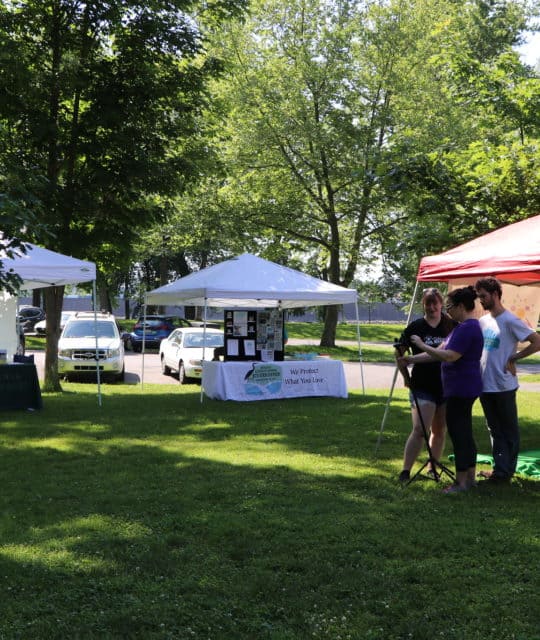
SGP’s Education & Outreach Program works to promote and educate the public about the Susquehanna Greenway, its on-going projects, and the many outdoor opportunities and amenities within the corridor.
The program also strives to create new tools and resources where needed, bringing people the very best of trail recommendations, paddling itineraries, outdoor news, and more to help connect them with activities right in their backyard on the beautiful Susquehanna Greenway.
SGP operates its Education & Outreach program through the following resources:
- Website & Social Media
- Printed Maps & Guides
- Feature Articles & Videos
- Newsletters
- Events
FAQs
What is a greenway?
A greenway is a corridor of open space that can vary greatly in scale and purpose, from a narrow ribbon of green that runs through urban, suburban, and rural areas to a wide-open corridor that incorporates diverse natural, cultural, and scenic features. Greenways include both land- or water-based areas, running along streams corridors, shorelines or wetlands.
Some greenways follow old railways, canals, ridge tops, or other natural and man-made features, and they can incorporate both public and private property. Greenways often provide for recreational opportunities, while others are established almost exclusively for environmental protection and are designed to limit human passage. Greenways differ in their location and function, but overall, a greenway network will protect natural, cultural, and scenic resources, provide recreational benefits, enhance the natural beauty and the quality of life in neighborhoods and communities, and stimulate economic development opportunities.
Who uses the greenway?
Greenway trails can be paved or unpaved, and can be designed to accommodate a variety of trail users, including bicyclists, walkers, hikers, joggers, skaters, horseback riders, and those confined to wheelchairs.
How are greenways funded?
There are many different sources of funds for the acquisition, development and management of greenway facilities. To maximize the amount of financial support for any greenway project, local public sector funds should be combined with funds from state, federal and private sector sources. Many communities involved with greenway implementation are choosing to leverage
local money as a match for outside funding sources, in essence multiplying their resources.
The Transportation Efficiency Act of the 21st Century (TEA21), and its predecessor, the Intermodal Surface Transportation Efficiency Act (ISTEA), is the single largest source of federal funding for greenway and other bicycle and pedestrian projects in the United States. It is administered through the United States Department of Transportation and provides up to 80% of the cost of developing and constructing facilities such as greenways, rail-trails, sidewalks and bike lanes.
Does the plan call for the removal of any homes or the taking of any privately owned property?
The Susquehanna Greenway Partnership facilitates the development of local projects and initiatives under the larger umbrella of the Susquehanna Greenway initiative. By connecting people and communities to the resources of the Susquehanna River, the Partnership seeks to enhance the region’s environment and create new opportunities for healthy living. The Susquehanna Greenway can also benefit the local economy by attracting visitors and new investment to riverfront communities.
The establishment of the Susquehanna Greenway—an interconnected network of trails and open space—involves the protection and use of resources in a manner that is consistent with local needs, policies, and development objectives. The Susquehanna Greenway is necessarily linked to the River and contiguous lands—both public lands and private property. Various approaches may be considered in the process of shaping local segments of the Greenway, including the use of easements for protecting scenery or providing public access to the river, and land acquisition.
The continuity of the Greenway is not dependent on continuous land-based rights-of-way or land-based trails. Other options, including the use of public roadways and even the River itself are viable options that may be considered. Because the Susquehanna Greenway Partnership is not structured to engage in property transactions, it has no fiduciary involvement in property transactions between units of government or between units of government and private property owners.
The Partnership espouses conservation, recreation, and access solutions that benefit private property owners as well as the public. The Partnership works with local, regional, and statewide entities—both public and private—to educate citizens, governments, and organizations on the importance of public-private investment in greenway development and the broader value of greenways to public health and community vitality.
How was the interactive Greenway Map created?
![]()
The interactive Greenway Map was developed with IMRivers
![]()
The icons used in the Greenway Map are from the Map Icons Collection