At a Glance
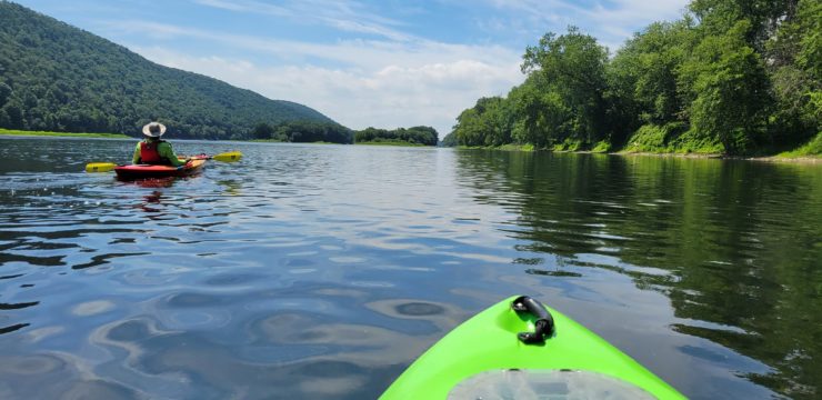
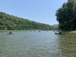
Paddle through the heart of the Endless Mountains on this scenic 14-mile stretch of the Susquehanna River’s North Branch. The region gets its name for the undulating hills of lush forests that will surround you on this journey. Depending on water levels, paddlers may experience some riffles or rapids, but the majority of the route is a peaceful one with a chance to see wildlife along the riverbanks and bird species soaring above. Vosburg Neck State Park offers a scenic lunch stop or alternative take-out along this winding water adventure.
Description
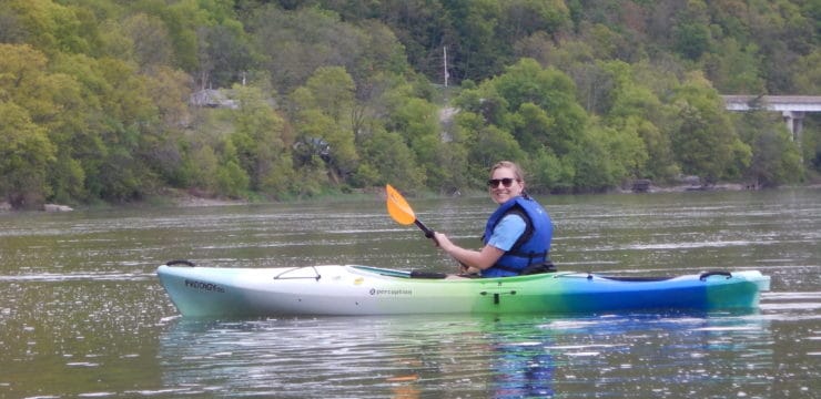
This day trip is a slightly longer paddle that is good for most skill levels but may be more of a challenge to novice paddlers. Due to Class 1 rapids, stand-up paddle boarding is not advised on this section. It is an ideal trip for those looking for an immersive nature experience.
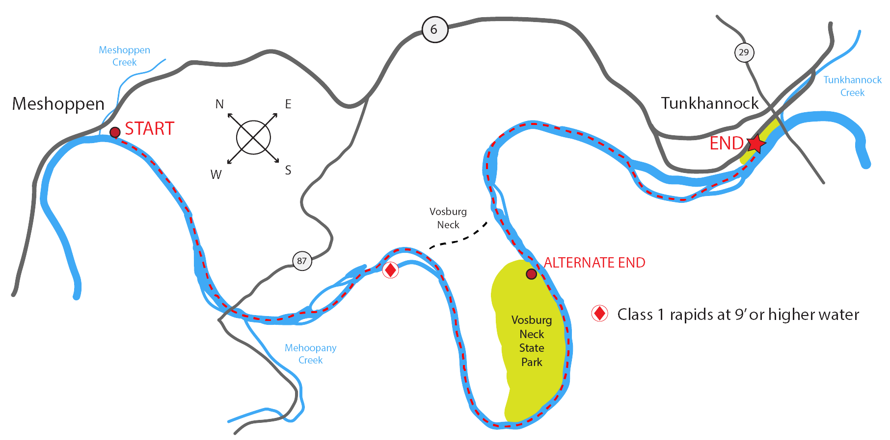
Launch at Meshoppen Boat Launch (River Mile 232.7). After roughly 2.5 miles, you will travel underneath the route 87 bridge and pass the town of Mehoopany on river right. Starting at river mile 229, you will begin to encounter a series of islands managed by DCNR. Paddlers should exercise caution at mile 228.3 on the right side of the islands as Class 1 rapids will be present with 9’ or higher river levels on the Meshoppen Gauge. Please navigate river left.
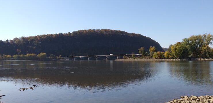
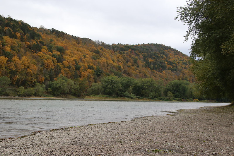
 At mile 228, paddlers will begin their journey around the Vosburg Neck, one of the most unique and beautiful areas in the Endless Mountain region. On the left side, you may notice the railroad tracks disappear into the trees where the Vosburg Railroad Tunnel begins. Bald Eagles are a common sight here, soaring over the 700-foot cliffs above the Susquehanna River.
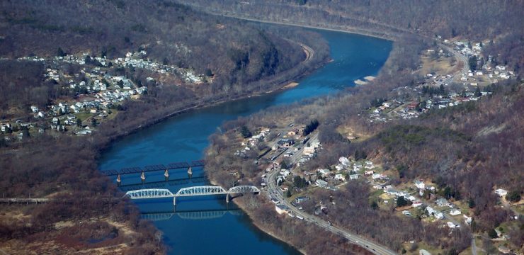
Continuing downstream, the river is lined with massive Silver Maple and Sycamore trees and features a variety of bird species and other wildlife that make this location attractive to naturalists. Camp Lackawanna begins on river left at mile 226.5 and ends at 225.3. This is private land and paddlers are not permitted to take out here or use the Lackawanna Access Site.
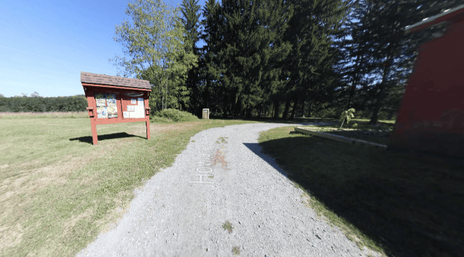
Less than a quarter mile downriver, paddlers will encounter Vosburg Neck State Park (formerly the Howland Preserve), which is also located on river left and features a public access boat launch at mile 223.3. The 669-acre preserve features historical landmarks including remnants of the Old North Branch Canal system, miles of immigrant-built stone walls, and a cemetery dating back to the 1700’s.
In addition to the historical remnants, Vosburg features 3 miles of walking trails. During late April, visitors can enjoy beautiful Virginia Bluebells in bloom. The launch here is an alternative take-out point if you would like to shorten your paddle to 10 miles.
After passing the Howland Access Site, paddlers will leave the Vosburg Neck. Caution should be taken from miles 223 to 219, checking USGS water levels to ensure they are above 9 feet. At river mile 220, there is a private access and stopping is not permitted here.
The final stretch will feature another series of islands. For the best nature viewing, it is recommended to stay on the right side of these islands. Immediately after passing these islands, navigate towards river left to exit the river at Tunkhannock Riverside Park Access (River Mile 218.5).
Amenities
Meshoppen Boat Launch does not feature any amenities; however, food, water, and restrooms are available in the nearby town of Meshoppen. Tunkhannock Riverside Park Borough Access features seasonal restrooms and picnic areas. Additional amenities such as food, lodging, and camping can be accessed in the nearby Susquehanna Greenway River Town of Tunkhannock.
Put In
River Mile 232.7: Meshoppen Boat Launch Municipal Access
Take Out
River Mile 218.5: Tunkhannock Riverside Park Borough Access
Take Out (Optional)
River Mile 223.3: Howland Access
This route corresponds with Section 6 of the Susquehanna River Water Trail – North Branch Map & Guide, a waterproof resource which provides additional details on amenities, point of interest, emergency contacts, and gage height.