At a Glance
Bucktail State Park Natural Area is a 16,433-acre scenic corridor along PA-120 between Emporium and Lock Haven. Known for its steep forested ridges and views of the Susquehanna River’s West Branch, the park is best experienced as a drive through the historic Bucktail Canyon. The route follows the path once traveled by Native Americans and Civil War soldiers, offering scenic views, wildlife watching, and a peaceful glimpse into Pennsylvania’s natural heritage. Visitors should note that much of the land is privately owned, and public access is limited to designated areas.
Description
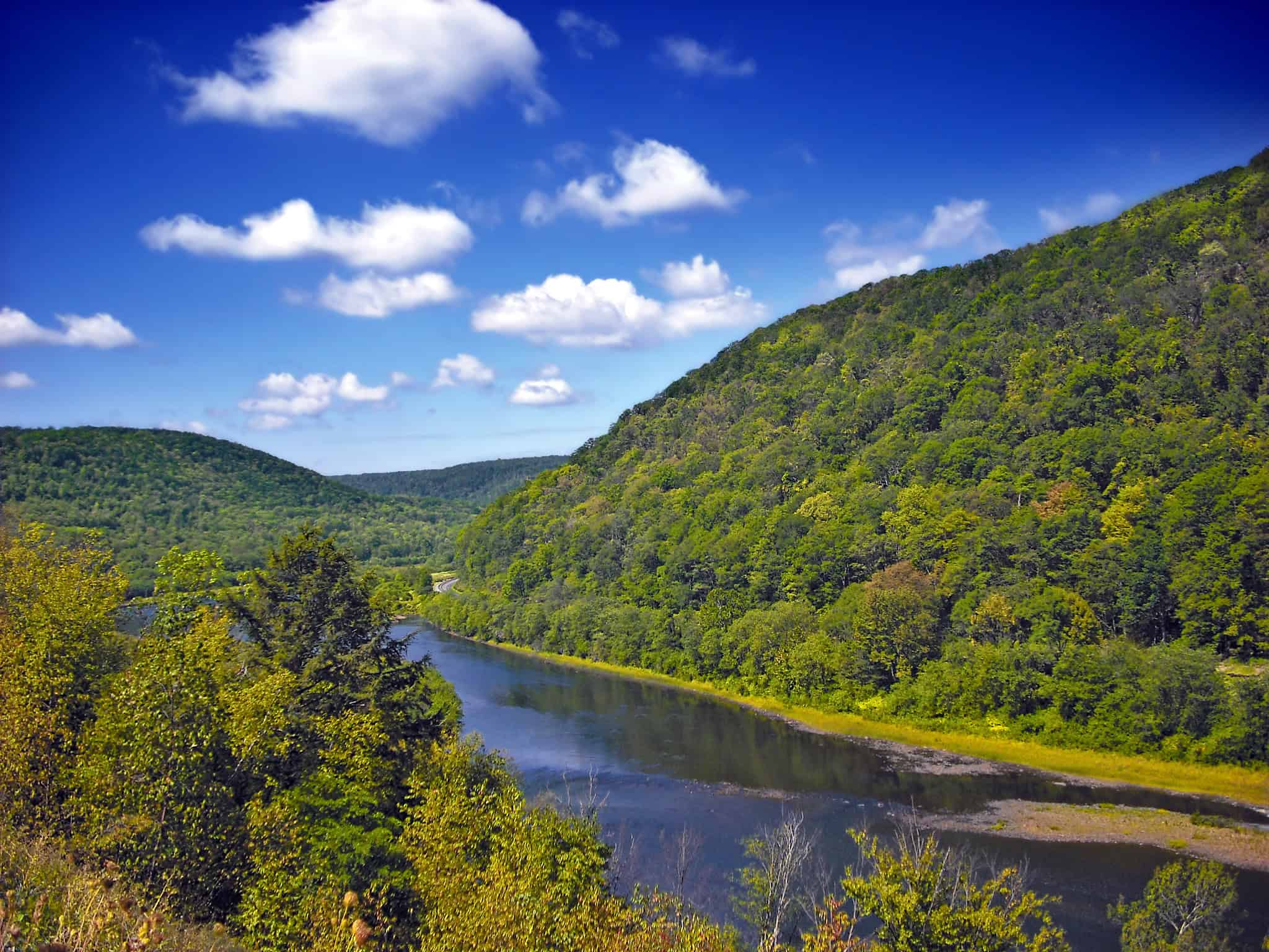
Bucktail State Park Natural Area, much of which is nestled alongside the Susquehanna River’s West Branch, showcases a beautiful array of forests and ridges that are iconic to the region. Encompassing 16,433-acres, it is not your traditional state park landscape and is most commonly visited as a scenic drive along PA-120.
The park’s unique charm lies in its rich history, ecological significance, and the captivating Bucktail Trail that winds through its narrow valley. It is named after the renowned American Civil War regiment, the Bucktails or Bucktail Rangers, and the area was also once traversed by Native Americans on the old Sinnemahoning Trail. Today, it stands as a testament to the historical and natural heritage of the region.
Photo by David Johnson
Apart from the three towns of Emporium, Renovo, and Lock Haven, the valley features pristine forested lands interspersed with occasional small villages and isolated farms. The striking Bucktail Canyon, characterized by steep mountains forming forested walls along the West Branch of the Susquehanna River and Sinnemahoning Creek, adds to the allure of Bucktail State Park Natural Area.
Visitors should be mindful that a significant portion of the park is privately owned, emphasizing the importance of obtaining permission from landowners before exploring beyond designated areas. Please note that public facilities and amenities are limited.
PARKING AND TRAIL ACCESS
Explore the beauty of Bucktail State Park Natural Area by embarking on the 75-mile scenic drive along PA-120, starting from Emporium, passing through Renovo, and culminating in Lock Haven. Ample parking facilities are available at designated points along the trail, providing convenient access to the unspoiled landscapes, steep mountains, and picturesque valleys that characterize this enchanting natural haven.
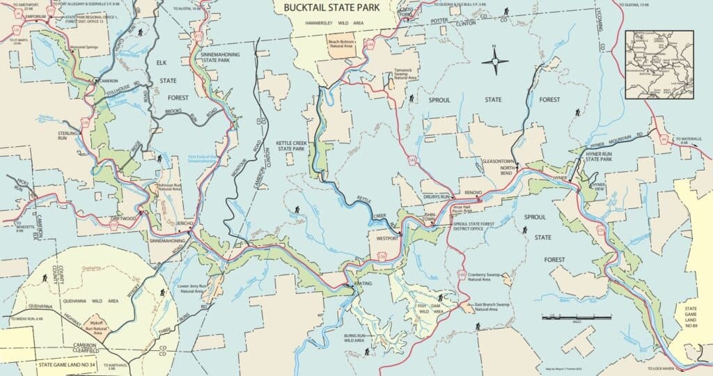
Bucktail State Park Natural Area Map
Information and Maps courtesy of PA DCNR
Amenities
Bucktail State Park Natural Area is primarily a scenic driving route with limited public facilities. There are no formal park amenities; visitors are encouraged to enjoy the landscape from the roadway and respect private property boundaries.