Description
Beautiful views of the Susquehanna River and surrounding forest are what await adventurous hikers on this moderate – difficult trail along the West Branch of the Susquehanna River. The route begins with a relaxed 1.2-mile hike along the River Trail before making a sharp left hand turn onto the Hyner View Trail. The River Trail is a semi-flat trail that narrows at points following the cliffs along the river. The 1.4-mile Hyner View Trail includes a significant amount of elevation gain as it traverses up the mountain to Hyner View State Park. This trail is challenging, but those who brave the climb are rewarded with panoramic views of the valley and Susquehanna River. This trail suggestion is an out and back, but more adventurous hikers have the opportunity to continue along the 16-mile loop trail network.
While Hyner View State Park is one of the smaller parks within Pennsylvania, it boasts one of the nicest views in DCNR’s Bureau of State Parks. Visitors can see vast distances both upstream and downstream of the overlook. Hyner View is also a popular location for hang gliding and photography.

Races
Parking and Trail Access
There is limited off-road parking on Huffrun Road North Bend, PA. Please be courteous of residents. More accessible parking is available at Hyner View State Park; along Hyner View Road, North Bend, PA 17760. Please note that you will be traveling in reverse along the trail from Hyner View.
Map
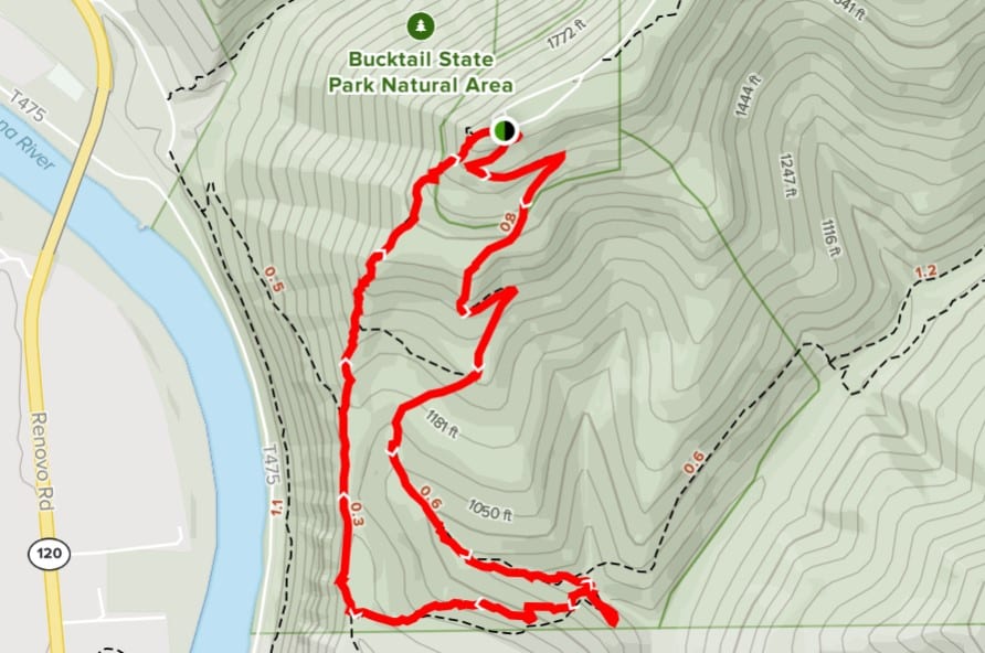
Map courtesy of All Trails


