

At a Glance
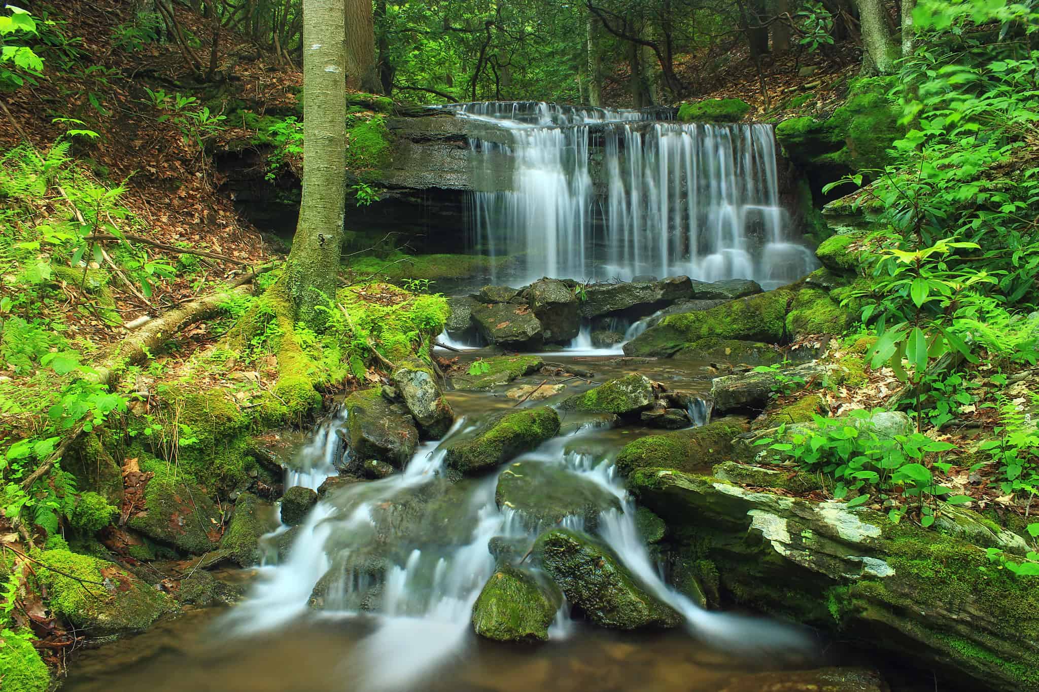
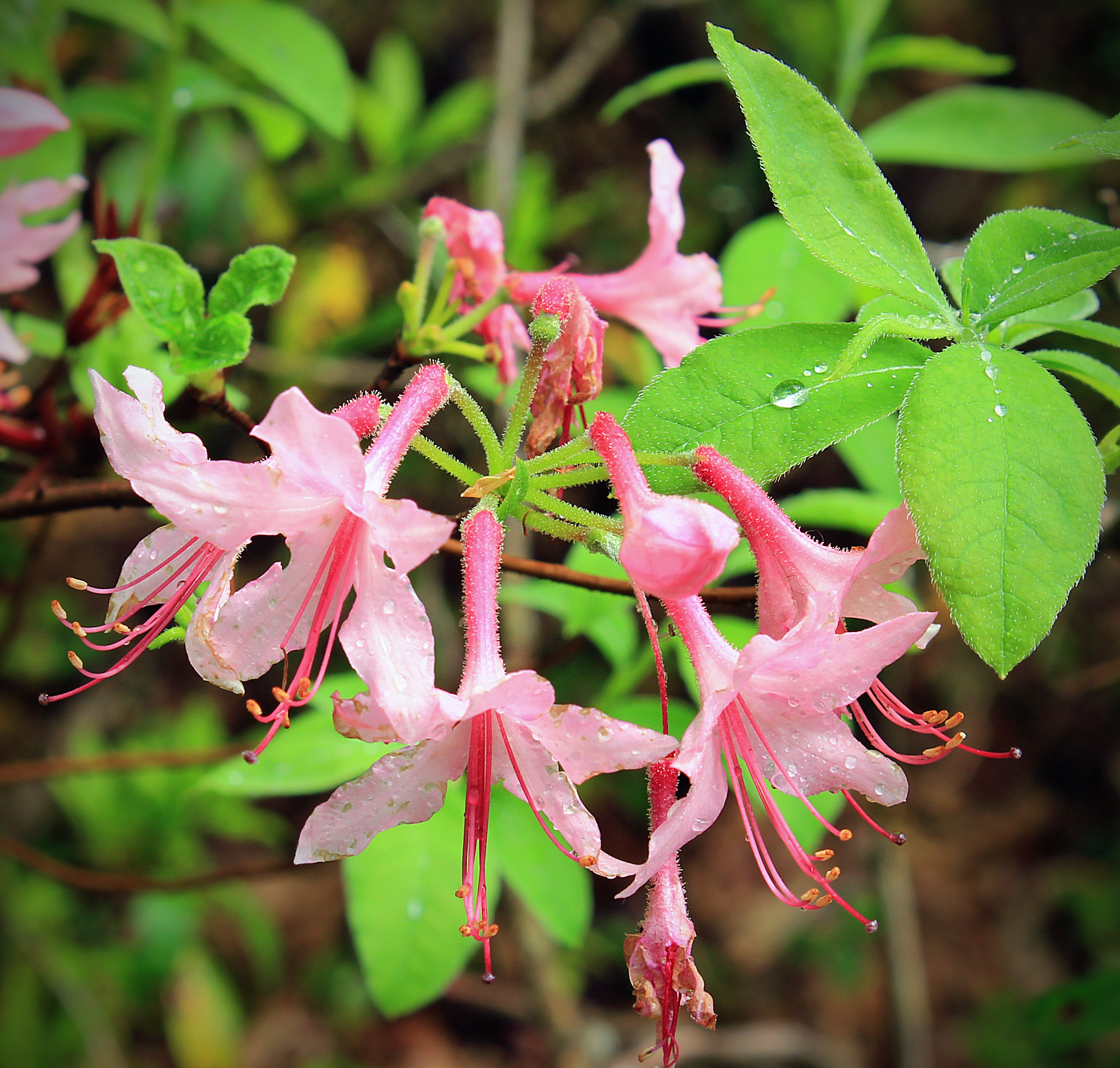
The Yost Run Trail Loop offers a variety of trail experiences perfect for both adventurous hikers seeking a rugged wilderness escape and outdoor enthusiasts looking to experience some of the prettiest scenery the state has to offer. Spanning a 7-mile moderate loop through Centre and Clinton counties, visitors can enjoy a scenic hike featuring lush mountain laurel, rhododendron, rushing waters, and the beautiful Yost Run Falls. The route provides a true backcountry experience with challenging sections, including a steep 1,000 foot climb over the course of a mile as you leave the run. The best times to visit these trails are during prime hiking seasons when you can fully immerse yourself in the wilderness setting. You’ll need to leave the casual walking shoes at home, a rugged path cut along steep, rocky hillsides awaits you, meaning you’ll need to watch your footing and pack plenty of drinking water.
Description
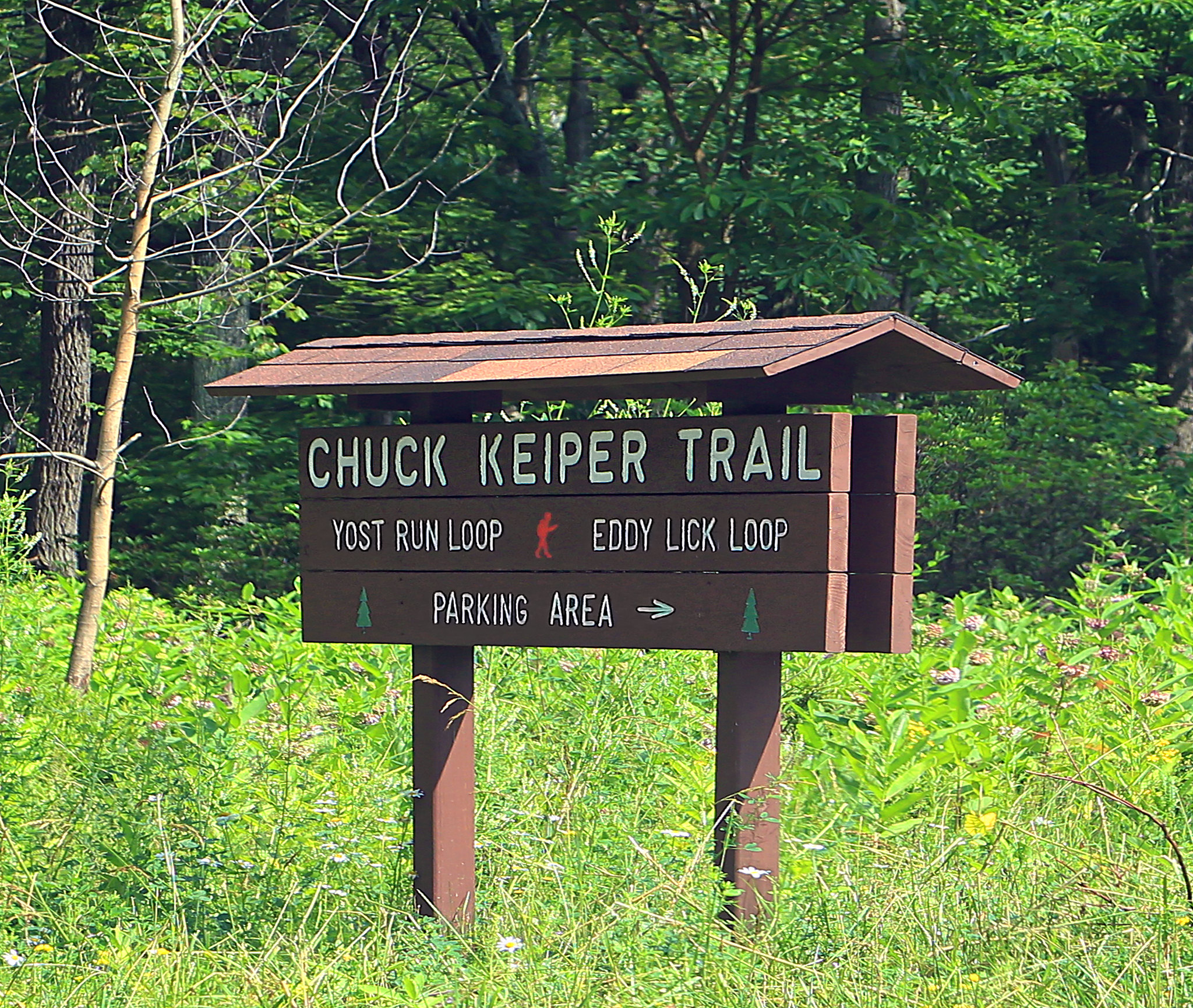
The Yost Run Trail Loop utilizes the Chuck Keiper and Eddy Lick Trails in Centre and Clinton Counties. The trailhead is located just south of the Clinton County/Centre County line along the western side of Route 144. This trail traverses some of the prettiest scenery the state has to offer: lush mountain laurel and rhododendron, rushing waters, Yost Run Falls, large trees, and steep rocky hillsides. All this adds up to a sensory experience of being in the wilderness, a place where you check the trail behind you for no apparent reason.
Difficulty rating is moderate due to length and some steep climbs. Terrain is rugged, with trails cut along steep rocky hillside. Hikers should watch their footing in some sections of this trail. Step wide off the downhill side of the trail and it would be a fast slide in the creek below. Show respect for all wildlife encountered along the trail. The trail climbs 1,000 feet over one mile as you leave Yost Run. Carry drinking water.

Photo courtesy of Nicholas A. Tonelli
Parking and Trail Access
You will find the trailhead for this hike on route PA-144. It can be accessed going north on PA-144 from the I-80 interchange. From this interchange, continue through Snow Shoe, staying on PA-144, for a total of 18.2 miles. You can also reach the trailhead from the north on PA-120 and turning onto PA-144 in the town of Renovo. From the intersection of PA-120 and PA-144 in Renovo, continue south for 17.7 miles. GPS coordinates for the parking access are: N 41° 11.07′, W 77° 52.73′.
Map