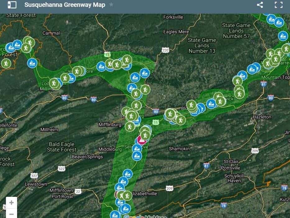
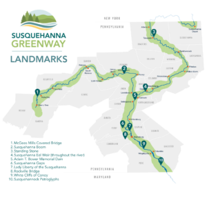
The Susquehanna River is rich with landmarks that tell the story of Pennsylvania’s natural forces, industrial growth, and cultural heritage. From its West Branch to the Lower Susquehanna, these sites offer a journey through time, revealing how the river has shaped both the landscape and the communities along its banks.
WEST BRANCH
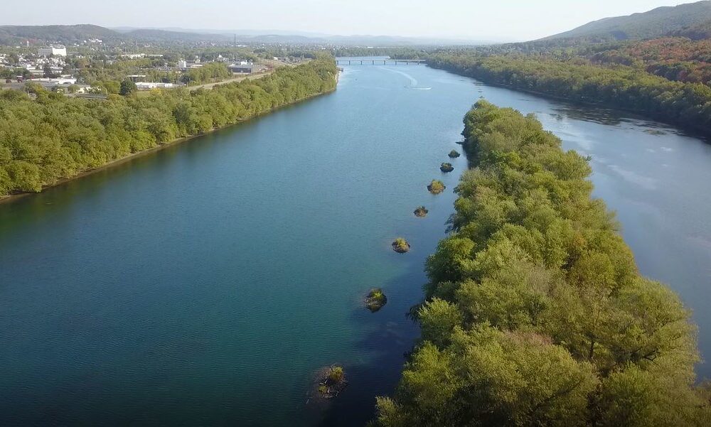
Susquehanna Boom
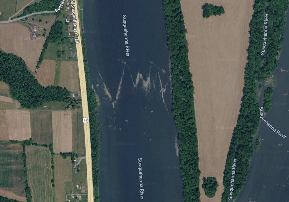
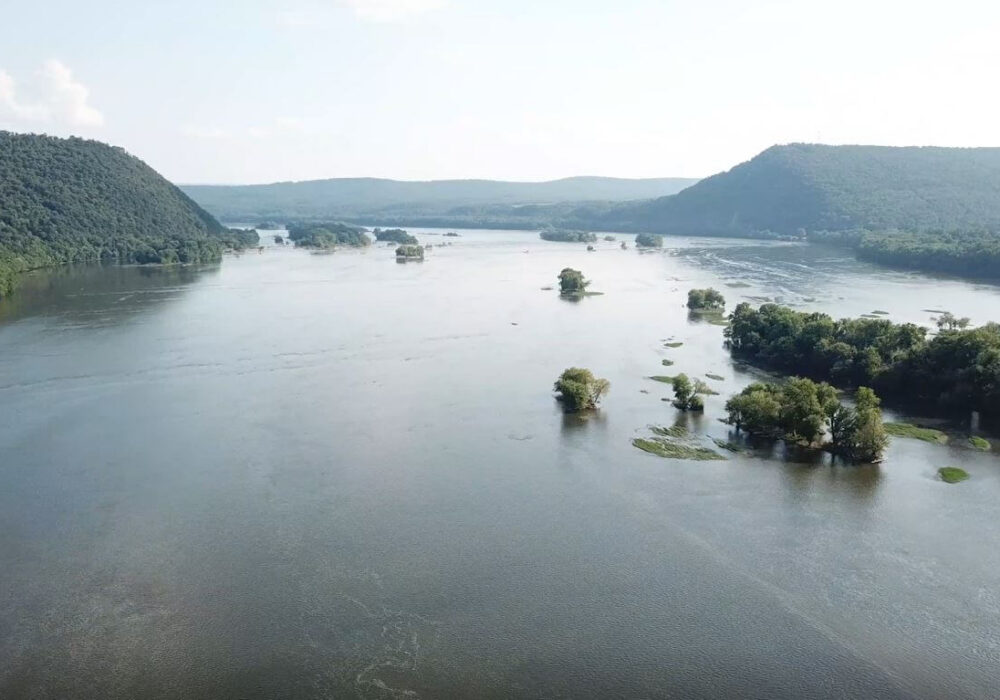
Along the West Branch near Williamsport, the remains of the Susquehanna Boom highlight a defining chapter in Pennsylvania’s lumber history. Developed in the mid-1800s by John Leighton, Major James, and John DuBois, the boom was created to corral and store timber floating downstream, extending the short logging season. Expanding from just 20 cribs to a seven-mile system of more than 350 stone-filled cribs, it could hold up to 300 million board feet of logs and supplied dozens of nearby sawmills. This innovation, paired with growing transportation and steam-powered industry, helped transform Williamsport into one of the wealthiest cities in the nation. Though dismantled in 1908 after years of heavy use and resource decline, remnants of the boom’s cribs can still be seen today as a dotted chain of manmade island—and explored by kayak!

McGees Mills Covered Bridge
Farther upstream, near Mahaffey, the McGees Mills Covered Bridge stands as a rare and enduring piece of Pennsylvania’s past. Built in 1873 by Thomas McGee using hand-hewn white pine, this Burr arch truss bridge is the only remaining covered bridge crossing the West Branch and has withstood more than 150 years of use and changing landscapes. Once a passage for horse-drawn travel and a witness to countless timber rafts floating downstream, the bridge reflects the region’s deep connection to the lumber industry. Listed on the National Register of Historic Places, it remains open to traffic today and is a favorite spot for picnicking, fishing, and photography. For paddlers along the West Branch Water Trail, passing beneath its wooden span offers a unique, up-close experience of a landmark that continues to carry both history and charm across the river.
NORTH BRANCH
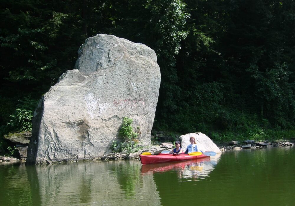
Standing Stone
On the North Branch near Towanda, the Standing Stone rises as a striking natural landmark with deep historical roots. This 25-foot-tall gray sandstone monolith, likely formed by a prehistoric landslide some 8,000 to 10,000 years ago, stands upright along the riverbank and has long served as a point of reference for travelers. First documented during Sullivan’s Expedition in 1779, the stone later gave its name to Standing Stone Township and marks the boundary of historic French Azilum. Today, it remains a prominent and easily recognizable feature along the river, an enduring blend of geologic history and cultural significance.
Photo by David Buck
Susquehanna Eel Weir
Beneath the surface of the river lies another, often unseen landmark; ancient eel weirs built by Native Americans to harvest migrating American eel. Found near historic Indigenous settlements, including the mouth of Mahoning Creek, these V-shaped stone formations funneled eels into narrow channels where they could be easily trapped or speared. Some stretched up to an eighth of a mile across, reflecting both their scale and ingenuity. For generations, eels were a vital food source, providing protein that could be preserved through the winter. Today, many of these submerged structures still endure despite centuries of flooding, offering a glimpse into the deep cultural knowledge and river-based lifeways that once defined the Susquehanna landscape.
MIDDLE BRANCH
Susquehanna Gaps
In the Middle Susquehanna region, the Susquehanna Water Gaps carve dramatic passages through the ridges of Dauphin County. This 1,921-acre National Natural Landmark, designated in 1968, features five water gaps where the Susquehanna River flows through Mahantango, Berry, Peters, Second, and Blue Mountains. Formed over millions of years through erosion along natural fractures in the rock, these gaps reveal how the ancestral river carved its path northwestward following the Alleghenian mountain-building event. Today, the Susquehanna Water Gaps offer an exceptional viewshed, blending geologic history with the scenic beauty of one of Pennsylvania’s most remarkable river landscapes.

Lady Liberty of the Susquehanna
Nearby in the Dauphin Narrows, the Susquehanna’s Lady Liberty adds a touch of whimsy to the river’s story. This 25-foot-tall replica of the Statue of Liberty stands atop an old railway piling between Marysville and Dauphin. First erected in 1986 as a plywood prank to celebrate the centennial of the original statue, it quickly captured the hearts of the community. After a storm destroyed the original in 1992, residents rallied to build a sturdier version, which was airlifted into place in 1997. Conceived by local activist Gene Stilp, the statue remains a beloved and unexpected landmark visible from Route 322.
Photo by Becki Kraft
Rockville Bridge
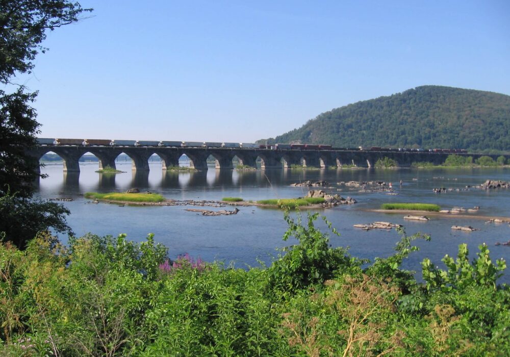
Just downstream, the Rockville Bridge rises over the river near Marysville as a testament to early 20th-century engineering. Completed between 1900 and 1902 by the Pennsylvania Railroad under Chief Engineer William H. Brown, this 3,380-foot-long arch bridge features 48 arches, each spanning 70 feet, and was constructed from 220,000 tons of sandstone and 150,000 cubic yards of concrete. Its Roman-inspired design allowed it to bear the enormous weight of trains during the height of the Industrial revolution, while its durable construction has withstood floods, wars, and decades of freeze-thaw cycles. A working landmark to this day, the Rockville Bridge not only connects the river’s banks but also serves as a symbol of the economic power and ingenuity that the railroad brought to Pennsylvania and the nation.

Adam T. Bower Memorial Dam
Farther along the river in Sunbury, the Adam T. Bower Dam holds the distinction of being the longest inflatable dam in the world. Maintained by Shikellamy State Park, this 2,100-foot-long structure creates Lake Agusta each summer, a 3,000-acre reservoir stretching over six and a half miles along the river’s North and West branches. The lake is a hub for boating, water skiing, and summer recreation, making the same a central attraction of the park. Originally known as the Sunbury Fabridam, it was renamed in 2001 to honor Adam T. Bower, a longtime state official. Plans are underway to add a fish ladder, allowing species like American shad to access the upper Susquehanna, continuing the dam’s role in both recreation and river stewardship.
LOWER BRANCH
Susquehannock Petroglyphs
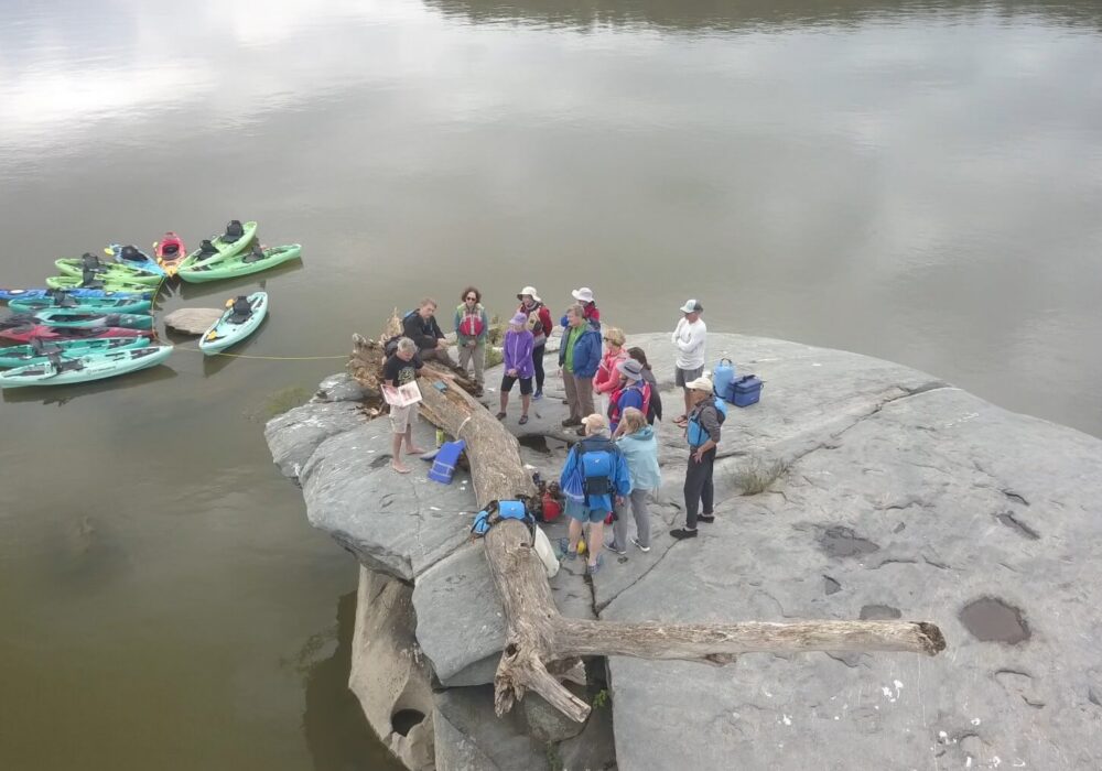
In the Lower Susquehanna region, the Susquehannock Petroglyphs offer a powerful connection to the region’s earliest inhabitants. Dating back 500 to 1,000 years, these intricate carvings were created first by the Algonquin-speaking Shenks Ferry people and later by the Susquehannocks, depicting humans, animals, spiritual symbols, and other meaningful designs. Etched into the hard granitic mica schist that resists centuries of flooding and ice, each petroglyph reflects the time, care, and significance invested by its creators. Accessible only by water, these enigmatic carvings continue to intrigue visitors, preserving the stories and artistry of the Susquehanna Valley’s ancient cultures.
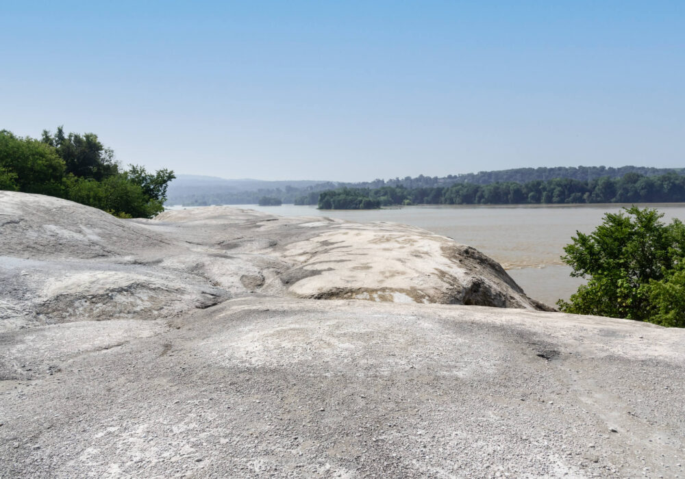
White Cliffs of Conoy
Rising 30 feet above the Lower Branch Susquehanna River in Lancaster County, the White Cliffs of Conoy offer a striking glimpse into the region’s industrial past. These bright limestone cliffs, remnants of a mid-1800s quarry, now overlook the ruins of a limestone factory and the ghost town of Billmyer, once a thriving company community before the quarry’s closure in the 1950s. Nature has since reclaimed much of the site, creating a dramatic contrast between the white cliffs and the lush river landscape. Today, the cliffs are accessible via the Northwest Lancaster County River Trail, providing a scenic route for walkers and bikers while allowing visitors to experience both the natural beauty and the historic echoes of Conoy Township’s industrial heritage.
Photo by Mark Kissinger