
Description
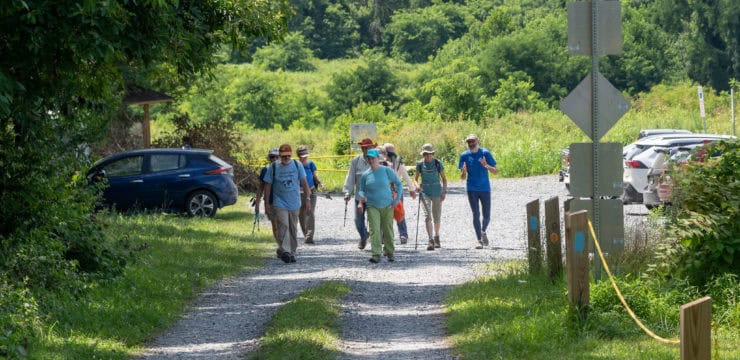
The Rhododendron Trail is a 1.2-mile hiking trail within Susquehannock State Park. The trail is moderately difficult and is great for hikers who are looking for an immersive forest experience and views of the Susquehanna River. Although equestrian riding is allowed on other trails in the park, it is not allowed on the Rhododendron Trail or on any of the lookouts. Due to the length, difficulty, and complexity of the trail system, users should be prepared with the proper footwear, a map, food, and water. Maps are available at the Susquehannock State Park office or on the DCNR website. Additionally, you should leave a trip plan outlining your route with a friend or family member.
This trail begins at the Susquehannock State Park office where a sign will be present at the trailhead. The James B. Longhouse, an original 1850 house, can be observed to the right of the trailhead. As you begin your trek, you will encounter Spring Trail on your right. Continue straight to stay on Rhododendron Trail. In another 500 feet, you will encounter Spring Trail again on your right. Veer left and travel west to stay on the trail. In another 100 feet, you will encounter a junction with Holly Trail. Keep right at the fork to stay on the trail.
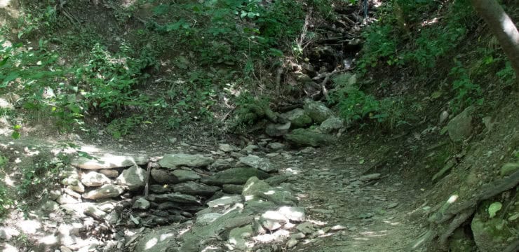
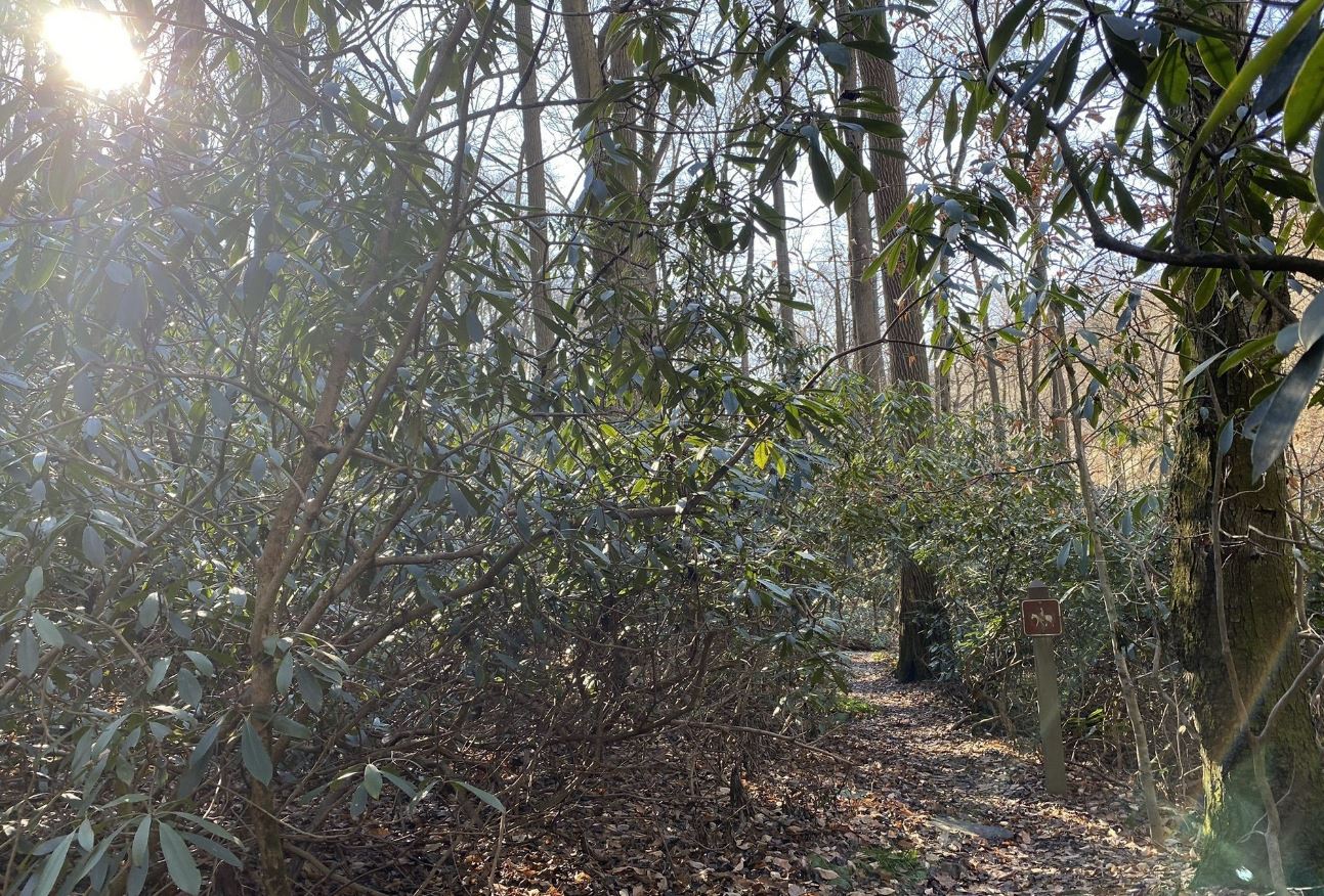
The trail will run downhill and feature two notable sites: the remnants of Neel Homestead Foundation and a massive old growth beech tree. As you begin to descend and travel closer to Wissler Run, you will encounter the thickets of Rhododendrons for which the trail is named for. During late June and early July, these evergreen shrubs bloom and show off their beautiful bell-shaped white flowers.
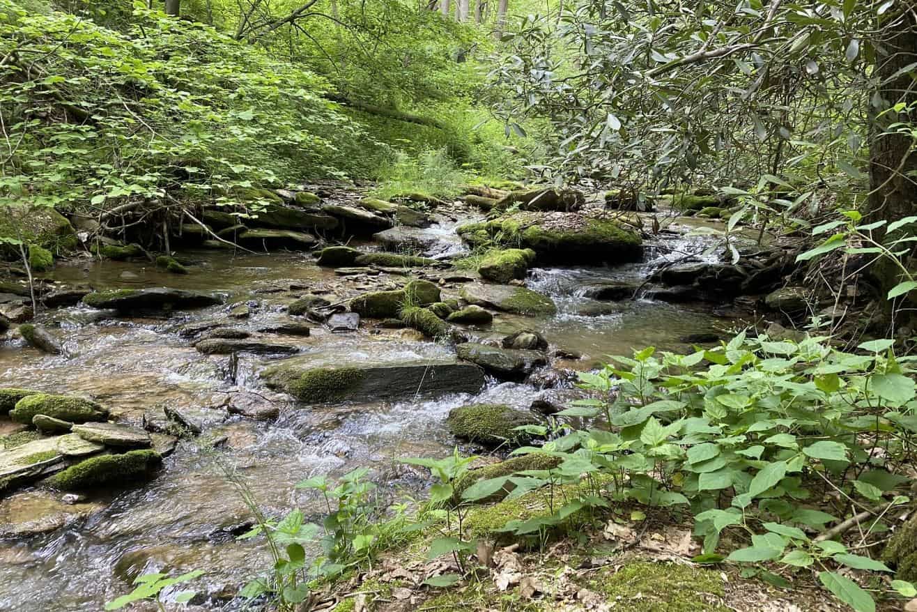
The trail continues southwest along Wissler Run for about 1000 feet and then turns east and ascends the hill. The trail will turn south and descend again, continuing another 1000 feet before turning east for a final 250-foot climb. The trail ends at a 3-way junction with Fire Trail. Hikers have the option to either turn left to head back to the parking lot or turn right to access Wissler’s Run Overlook.
To head back to the parking lot, turn left and head east on Fire Trail for 1000 feet until you encounter Park Rd. Continue east on Park Rd for 500 feet until you reach the parking lot.
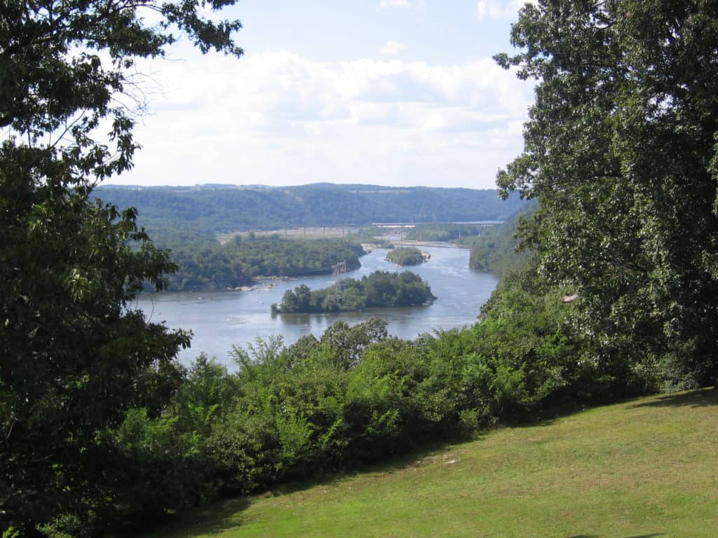
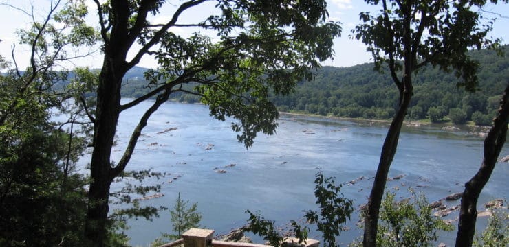
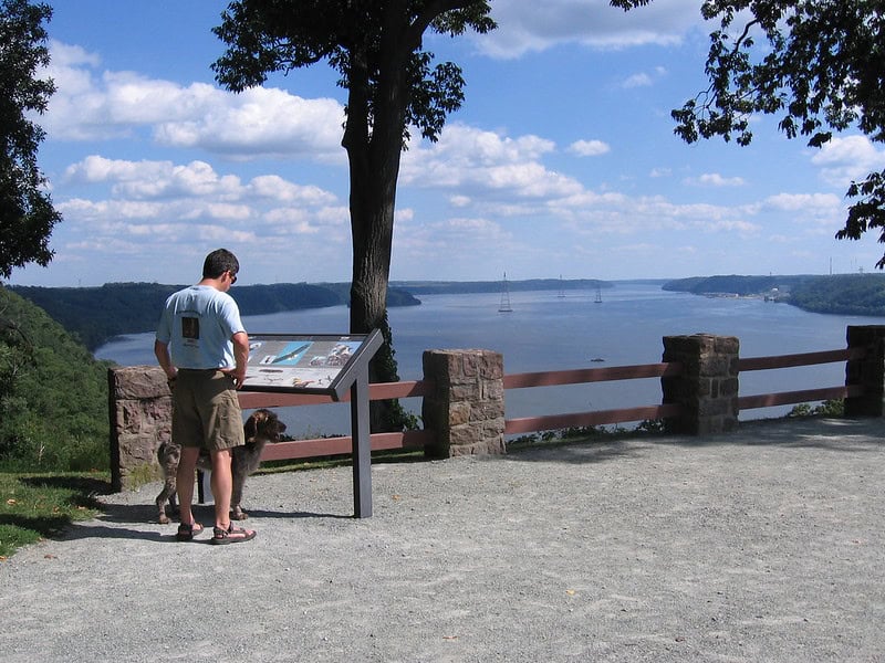
View from Wissler’s Run Overlook at Susquehannock SP. (Photo source: unknown)
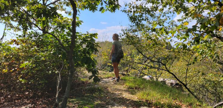
To head to Wissler’s Run Overlook, turn right and head west on Fire Trail for 400 feet. At the junction, turn right and follow the trail until it ends at the overlook. The overlook provides beautiful views of the Conowingo Reservoir, a section of the Susquehanna River created by the Holtwood Dam. During spring and fall bird migrations, large groups of hawks, known as kettles, can be seen circling overhead. However, raptors such as Turkey Vultures, Red-tailed Hawks, and Bald Eagles can be seen at any time of the year.
Hikers have the option to follow Fire Trail back to the parking lot or utilize the other trails in the park to enlarge the loop. However, if you choose to alter your route, make sure you have enough water, energy, and daylight to finish your trek. Additionally, the terrain is rocky and can be difficult to traverse, increasing your hiking time.
Parking and Trail Access
The park address is 1880 Park Dr, Drumore, PA 17518
From US-222 Southbound: Continue straight at the intersection of Long Ln to access US-272 S – Willow Street Pike. Continue on US-272 S for 8.6 miles then turn right onto PA-372 W. Continue on PA-372 W for 2.7 miles then turn left onto Susquehannock Dr. Continue on Susquehannock Dr for 4 miles, making a right followed by a left and a left again to stay on Susquehannock Dr. Turn right onto State Park Dr and follow for 0.8 miles. The parking lot will be on the right-hand side next to the park office.
From US-222 Northbound: Turn left onto Furniss Road and continue for 3.1 miles. Turn left at Harmon Ridge Rd, continue for 2 miles, then turn right onto Susquehannock Dr. Continue on Susquehannock Dr for 1.4 miles then turn left onto State Park Rd. Continue on State Park for 0.8 miles. The parking lot will be on the right-hand side next to the park office.
From PA-372 Eastbound: Continue over the bridge then turn right onto River Rd. Continue onto River Rd for 2 miles then turn right onto Furniss Rd. Continue on Furniss Rd for 1 mile then make a sharp right onto Susquehannock Dr. Continue for 0.3 miles then turn left to stay on Susquehannock Dr. Continue for another 0.6 miles then turn right onto State Park Rd. Continue on State Park Rd. for 0.8 miles. The parking lot will be on the right-hand side next to the park office.
Information courtesy of alltrails.com, dcrn.pa.gov, hikingproject.com
Map
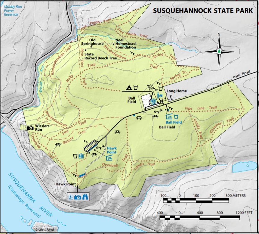
Susquehannock State Park Map (Map courtesy of DCNR)