By Lauren Bupp
In celebration of his 75th birthday, Harold ‘Hank’ Webster decided to do something a little different this year. In addition to the traditional birthday party, Webster elected to take to the West Branch of the Susquehanna River for a 150-mile kayaking adventure. After his grand adventure this past May, Hank sat down with the Susquehanna Greenway Partnership’s Lauren Bupp to tell us more about his motivation and give some tips for those interested in paddling this section of the river.
Lauren Bupp: Why paddle 150 miles, why not 75?
Harold Webster: Because 150 is twice as good as 75. I’ve wanted to do the wild part of the West Branch down to Lock Haven for quite a while. This was the year to do it; I’m probably not going to get more capable.
Bupp: What is your connection to the Susquehanna River?
Webster: I grew up along the North Branch of the Susquehanna, near Bradford County. I was also the director of a conservation district for 20 years and focused on improving steam access.
Bupp: How long did the total trip take you?
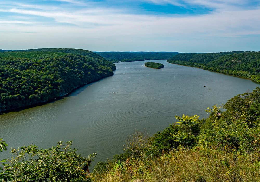
Webster: It took 7 days. I launched at 1:30 PM on May 19, 2017 at Cherry Tree in Cambria County and ended my trip on May 25, at Lock Haven in Clinton County. Each day ranged from five to ten hours of paddling, about 25 miles, but it all depended on where it was convenient to camp for the night.
Bupp: What did you enjoy most on your paddling trip?
Webster: The most satisfying aspects of the trip were going through the stretches of rapids without capsizing, the scenic stretches with water falls, and waking up with the birds chirping in solitude. It was all so refreshing.
Bupp: Did you have any challenges during the planning process?
Webster: The main challenges during the planning process were determining the length of each segment, identifying areas where it was okay to camp, and locating where to get water. I had previously paddled the middle sections of my route at least twice and paddled most of the rest of the trip on the Susquehanna Greenway Partnership’s West Branch Sojourn. I had tackled Cherry Tree to McAfee and Keating to Lock Haven, and I relied heavily on the West Branch water trail map.
Susquehanna Greenway Partnership (SGP) says:
During your planning process be sure to utilize your water trail map. A large portion of property along the Susquehanna is privately owned, however some state forests, state parks, and municipalities will allow you to primitively camp on their property if given notice. Another great source of information is your local outfitter.
Bupp: Were you able to locate maps and things needed for the trip easily?
Webster: I already had the maps purchased for this trip from previously partaking in the West Branch sojourn about 5 years ago as well as using it for Boy Scouts. But I relied on them heavily and they are easy to obtain.
SGP says: Waterproof water trail maps with access points of the West Branch can be purchased online at lumberheritage.org.
Bupp: Did you have any challenges during the paddle?
Webster: Towards the end of the paddle, I encountered some inclement weather near Shawville, PA. Thankfully there were no damns or obstacles in this stretch of river, so I was able to pick up speed and shave a day off my itinerary. I was doing about 30 miles for a few days. Additionally, the upper end of the Susquehanna had gotten heavy rains that weekend, so at one point the water levels went up about 8 feet over night.
Bupp: How was the overall weather?
Webster: It was a little cooler than average, and there were a couple of nights that it dropped down into the 40’s. For half of the trip is was lovely, mostly blue skies and it warmed up into the 70’s. It was good to have a sleeping bag at night, but you could be in short sleeves while paddling.
Bupp: Do you have any advice for someone that wants to do a similar paddling trip?
Webster: Don’t go alone; none of my friends were crazy enough to go along with me. Use your West Branch Water Trail map and make sure you have your Life jacket (PFD). Look ahead at the weather and track the USGS river gauges for the segments that you plan to paddle. If you are paddling below Shawville, look at the Karthaus gauges. If the river level is below two feet, there will be some walking portions. Also, make sure you have the basics: water, snacks, sunscreen, a hat, and things like that. If you are a beginner, try practicing on flatwater and start by doing day-trips. The West Branch has a history of losing water when you get into June, so be wary of that and plan accordingly. If you are camping, practice Leave No Trace principles; if you can carry it in, you can carry it out.
Bupp: Could you suggest any day trips based off your paddle?
A Webster: Launch at Shawville, which is just below the power plant and paddle to Deer Creek. Or you can try doing Karthus to Keating. That is a 22-mile paddle without any river crossings. You would be going through the Pennsylvania Wilds territory.
The West Branch Water Trail runs 283 miles from Cambria County to the Confluence in Northumberland County were it finally joins the main branch of the Susquehanna. “The West Branch has a lot to offer,” says Webster. If 150 was twice as good for Harold, what’s twice as good for you?