
At a Glance
The Houtzdale Line Trail offers a variety of trail experiences perfect for both mountain bikers and families seeking a quiet nature walk. Spanning 11 miles through Clearfield County, visitors can enjoy a multi use route that traverses scenic wetlands, upland forests, and stream corridors. While the central 8-mile section features a smoothly graded and compacted surface, the extreme east and west ends remain in a rougher, more rugged condition. The best times to visit these trails are year-round for convenient recreation.
Description
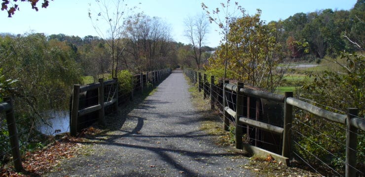
Purchased from Conrail in 1994 following abandonment, the corridor was converted to a multi-use path in order to preserve the land as a public asset. The trail is lined with hedgerows of multiflora rose and other deciduous shrubs. The entire length of the Houtzdale Line Trail is open for use with nearly 8 miles of improved surface from the Muddy Run Bridge west of SR-2005 at Smoke Run to SR-2007 just east of Houtzdale. The trail has been graded, compacted, and marked with mileposts.
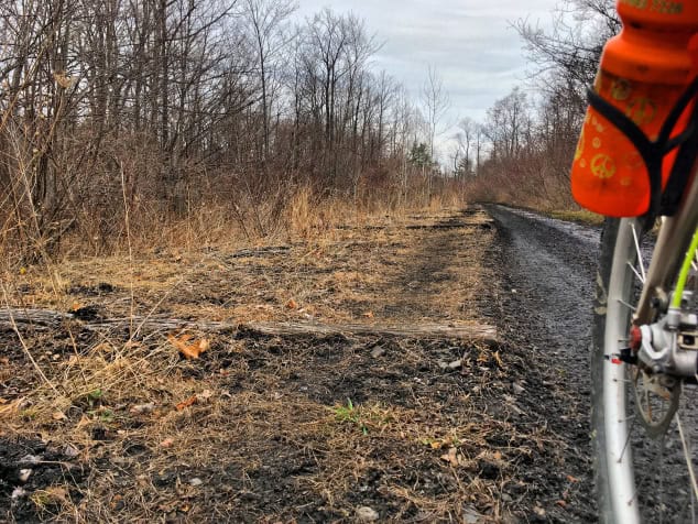
The extreme east and west ends of the trail remain in rough condition but are usable by hikers, mountain bikers, and cross-country skiers. Beyond the towns of Ramey and Houtzdale, the trail traverses natural areas of wetlands, upland forest, and stream corridor with an abundance of wildlife and native plants.

Photos courtesy of Helena Kotala
Parking and Trail Access
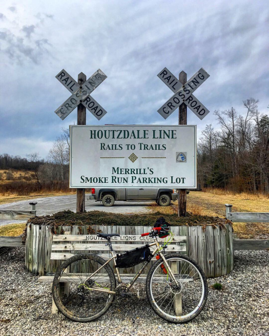
To reach the trail crossing in Houtzdale from Interstate-99, take 453 North to Viola and turn onto 153 North. From I-80 take the Clearfield Exit for Route 879 South to 153 South. Parking can be found behind the BiLo Supermarket on Route 53, east of Houtzdale. On-street parking is available in Houtzdale and in Ramey on streets running parallel to the trail off State Route 453. A marked parking lot is now located off State Route 2005 in Smoke Run.