
At a Glance
“
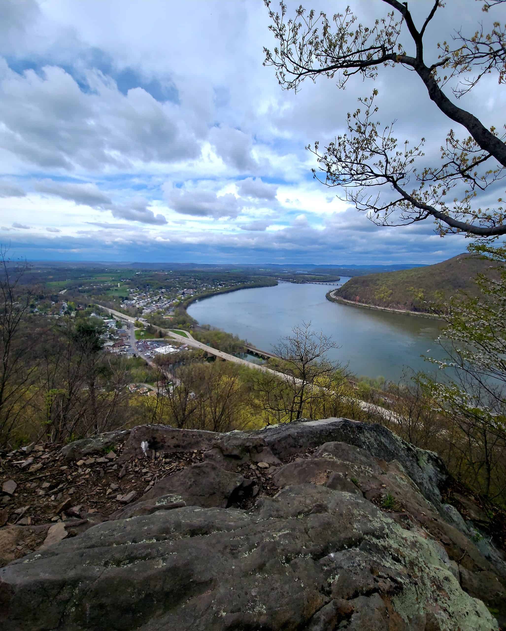
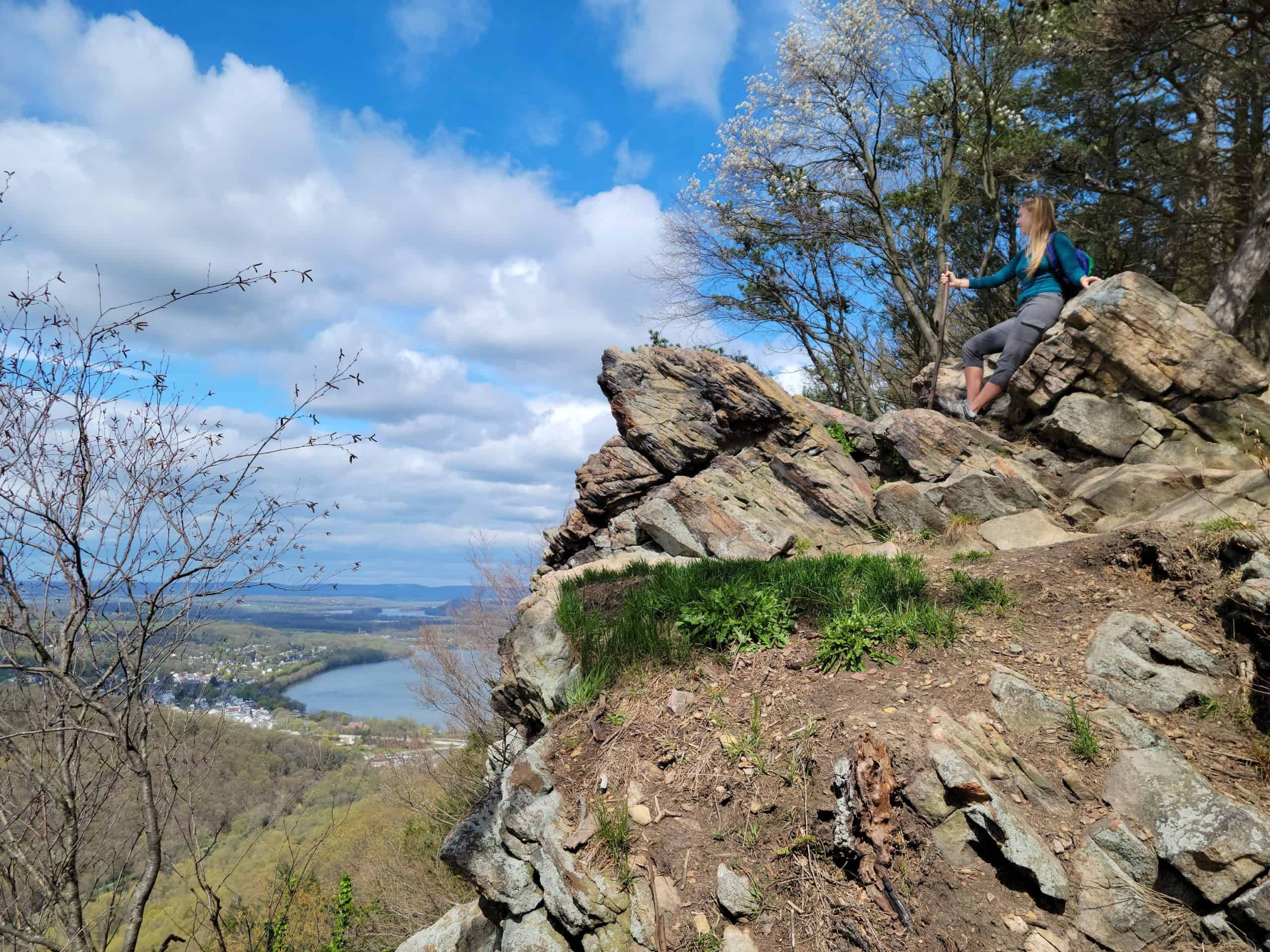
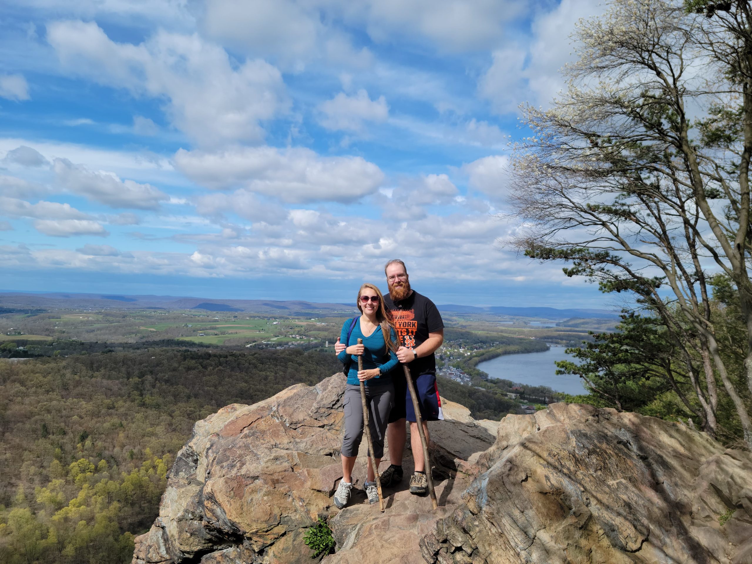
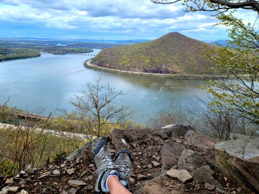
I’m a sucker for a good overlook, and Hawk Rock delivers not just one, but two stunning views! It’s incredible to stand where the iconic Appalachian Trail crosses the Susquehanna River and take it all in. If you’re up for a challenge, the loop to the second overlook—Eagle’s Edge—is worth it, but be prepared: it’s steep, narrow, and unmarked. Definitely a memorable hike!”
Description
This short hike takes visitors on one of the most iconic trails in the U.S., the Appalachian Trail, and rewards them with a stunning overlook of the Susquehanna River.
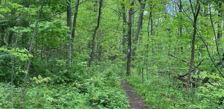
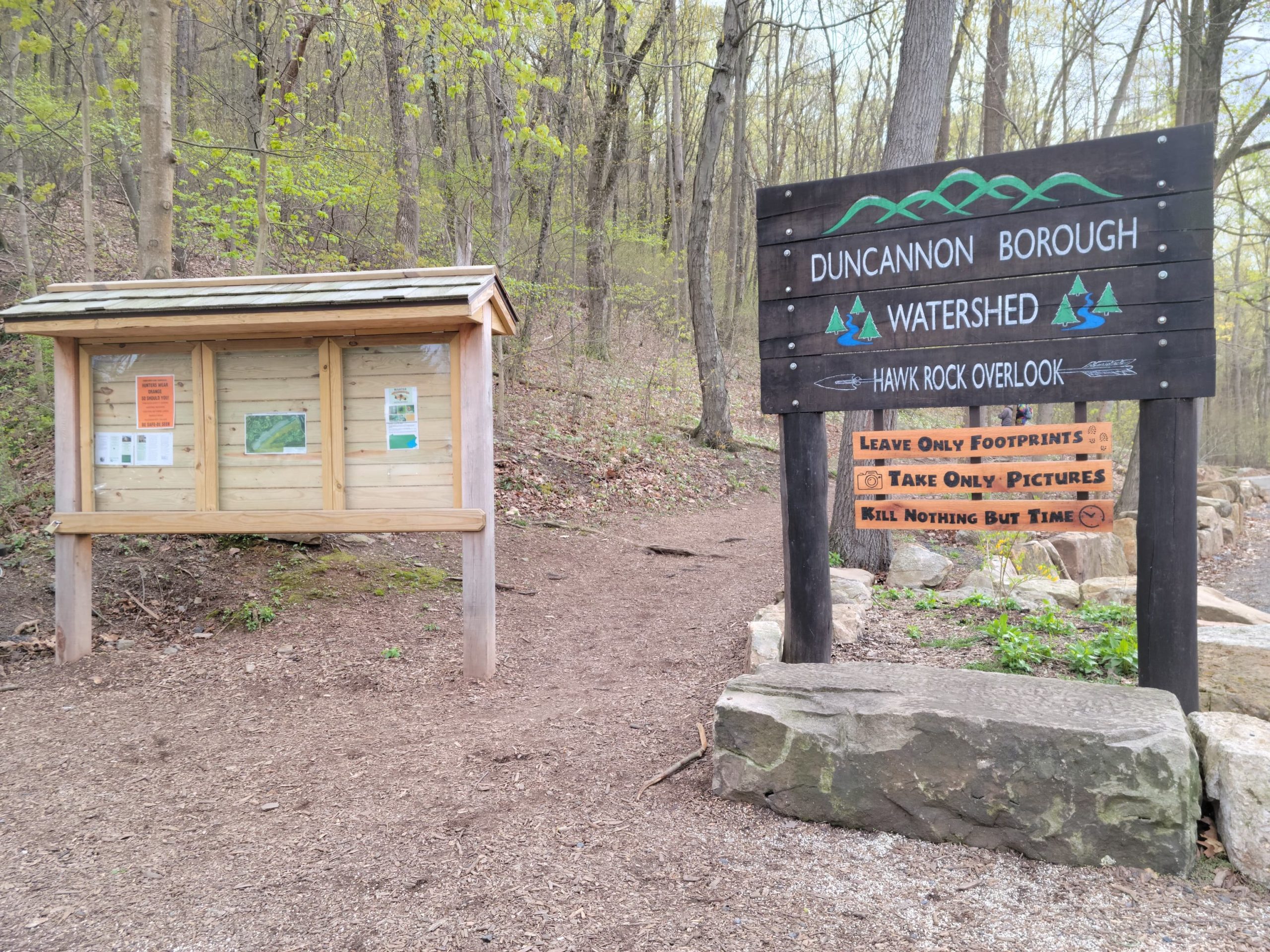
From the main parking area, take the trail going uphill next to the road. While this connector trail is steep, it is easy to follow and relatively smooth. After about 10 minutes, you will see the Appalachian Trail (AT) coming in on a sharp turn from your left; keep right onto the AT. Once on the AT, you will follow the white blazes located on the trees up to Hawk Rock Trail.
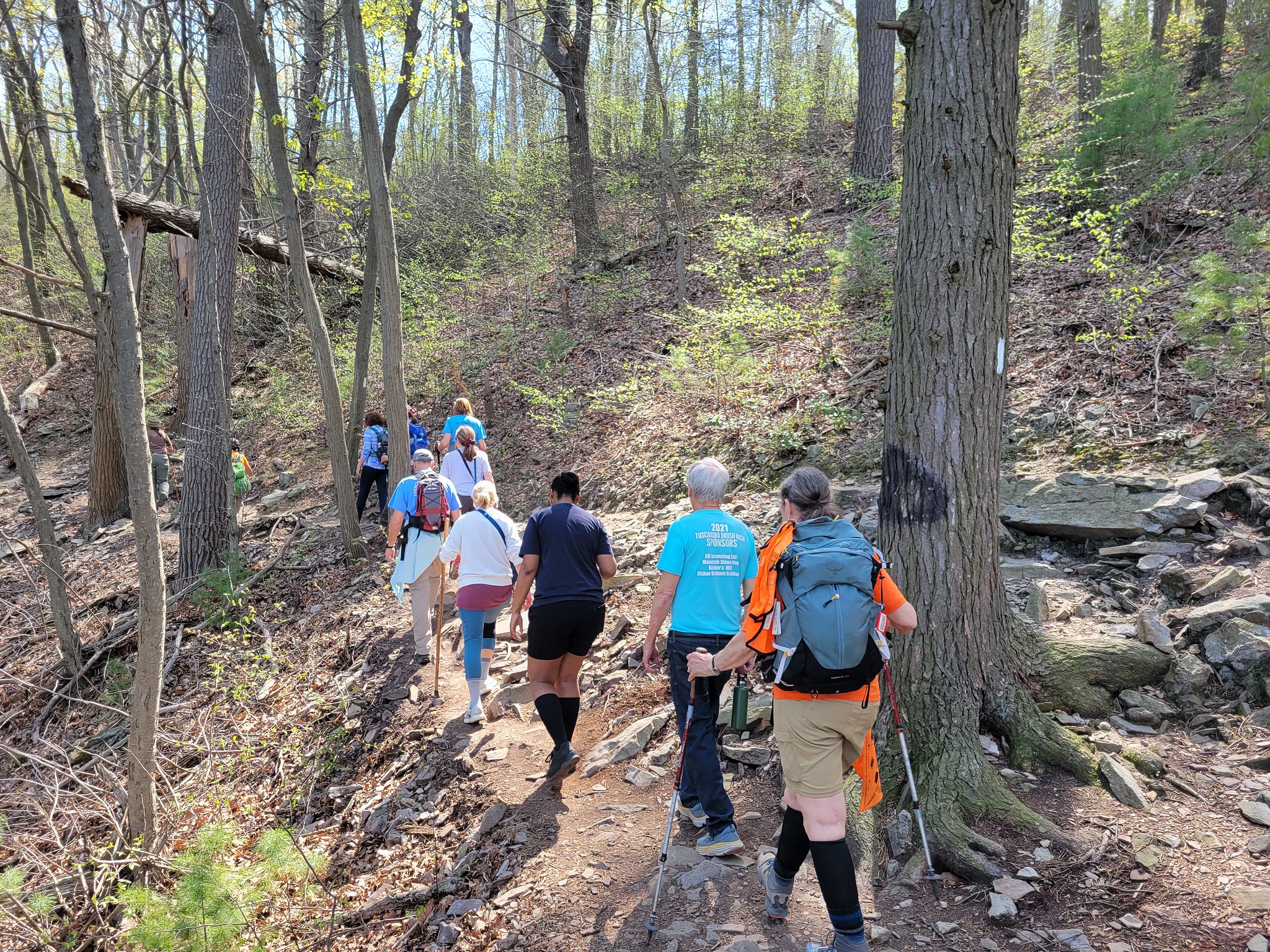
After a few minutes on the AT, the trail becomes very rocky. Take care to watch your step; remember to look for the white blazes, as they will be helpful in keeping you on the trail in this area. Once you pass the rocks, you will have another 5-10 minutes of hiking before you reach Hawk Rock Overlook, about a 30-minute hike all together; add time for stops along the way. There are some steep rocky steps as you get closer to the top.
After you have enjoyed the views at Hawk Rock Overlook, there are two options:
- Option 1: Head back down the mountain the way you came along the AT. The total hike is 1.6 miles if you choose this route, and the elevation is more gradual.
- Option 2: Continue along the ridgetop to Eagle’s Edge Vista for another view. The total hike is about 1.8 miles if you choose this route. The way down is much steeper, narrower, and unmarked, thus more challenging. Trekking poles are recommended.
Please Note: Do not attempt to walk this route when it is wet or icy, as the trail becomes slippery.
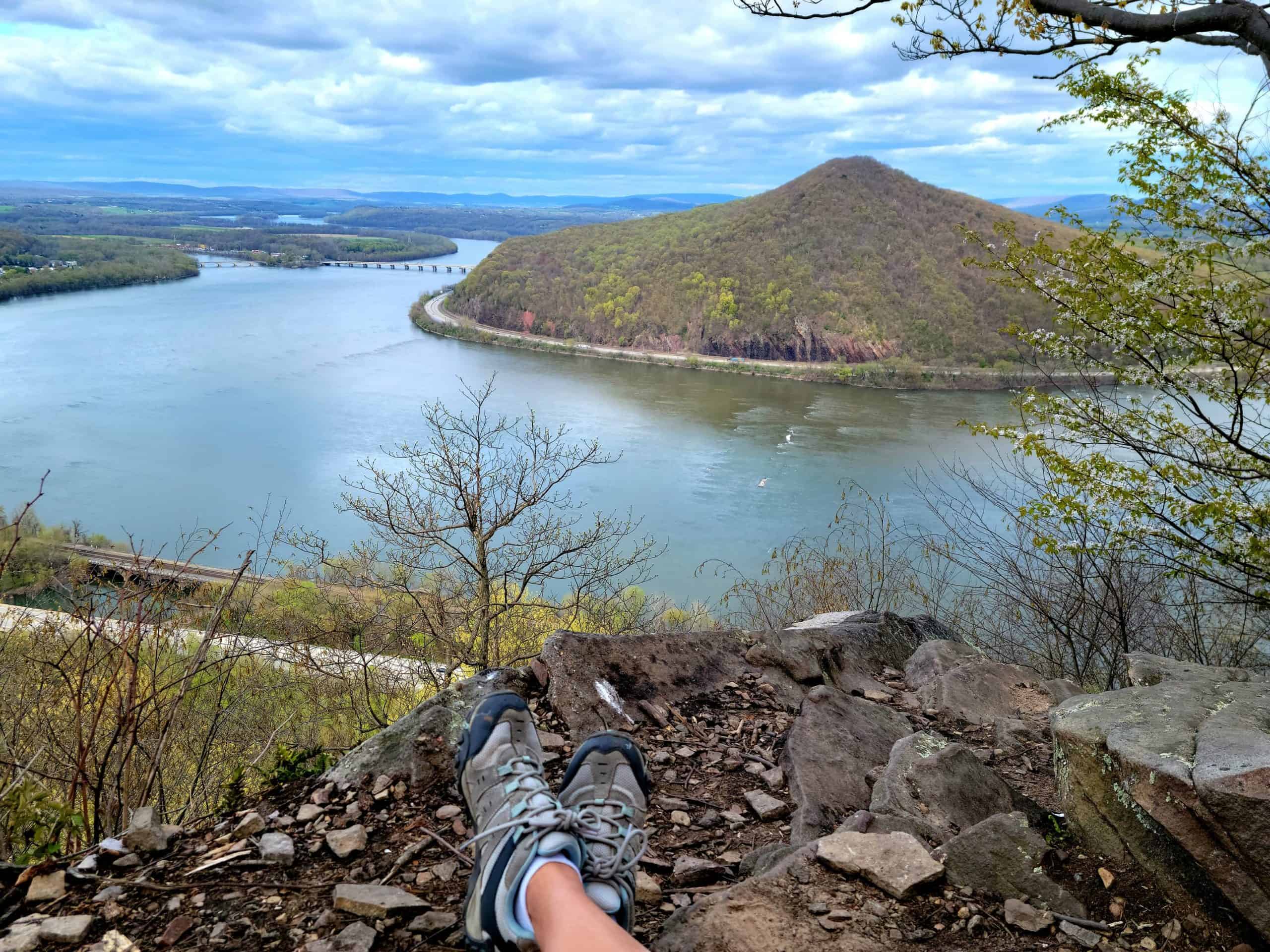
View from Eagle’s Edge Vista
Maps
Option 1
Option 2
Parking and Trail Access
From Highway 15, take the exit for 274 West to Duncannon. Turn left on South Main Street; South Main Street becomes Inn Road. After crossing Sherman Creek, take your first right onto Little Boston Road. Little Boston Road intersects Watershed Drive. Follow Watershed Drive to a gravel parking lot behind some residential homes. The trail is accessible from the gravel lot.
Explore more with our Interactive Map