When it comes to planning a trip on the Susquehanna River, checking water levels should be at the top of your list. The USGS has an online tool, known as a river gage, that can help you track this data and prepare for your next on-water adventure.
Our FAQ below will guide you through the ins and outs of these gages and how to use them.
FAQ
What is a river gage?
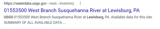
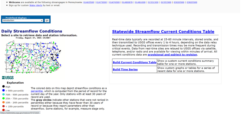
A river gage is a device that measures the water level height in different parts of the Susquehanna River. It’s a tool that you can view online by entering “USGS” and your local area in a basic search engine. For example, search “USGS Lewisburg” and you will find a listing for the “West Branch Susquehanna River at Lewisburg, PA,” as shown below.
Why do I need to check river levels?
River levels can change dramatically due to flooding or drought, so it is always important to check the height before your head out on an adventure. High water generally increases difficulty due to faster flow and increased hazards such as low bridges, floodwater debris, and low hanging trees. Low water can be just as difficult as shallows may turn into dry banks and low areas become muddy sandbars.
Where do I go to find out the river height?
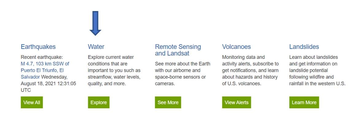
When calculating the river height, you will need to visit the USGS website at waterdata.usgs.gov. The best way to find your local area’s height is 1) Use a search engine to enter your location along with “USGS,” as demonstrated in the question above, or 2) Go onto the USGS Website and scroll to find “Water”.
When you click “Explore,” there will be a page showing a map of the United States. To get to your state, there is a drop-down menu for “Geographic Area” in the upper right-hand corner of the page. There you can select Pennsylvania or any state you would like to check water levels.
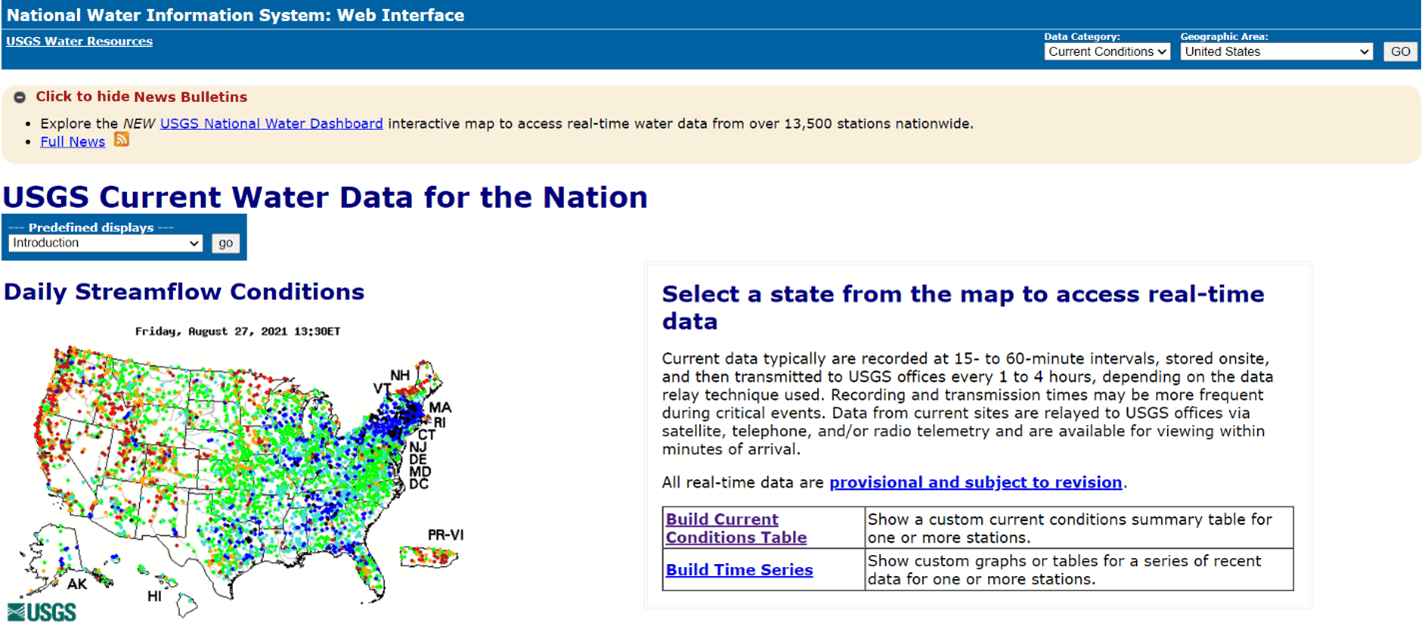
Once you have chosen your geographic area, the website will show your state covered in colored dots. These dots indicate areas that are recorded by USGS and what percentile the water levels are in. We’ll get more into what percentiles mean regarding safety in the next question.
When you get to your location’s information, there will be a section above the graphs that outlines the site details. For some spots along the Susquehanna River, they will supply NWS information, which is beneficial because it indicates what heights of the river are a cause for concern. So, at the Williamsport section of the Susquehanna River, it begins to flood at 20 feet but will be watched and observed at 10 feet. This is all good information to know as you look over the river gage map for your region!
Please note that flooding levels on these gages are often higher than what constituents flooding conditions for a boater. Use your best judgement when deciding to advance a trip and consult outfitters or river experts when in doubt.
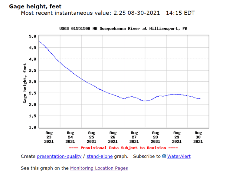
Scroll down and you will finally arrive at the graph for your location. Here you can read the map to track the height progression since the last round of data and subscribe to “WaterAlerts,” which is an automated messaging system to notify you of dangerous waters. If you do not want to subscribe to messages, you can also click on “Monitoring Location Pages,” which will direct you to live information about the height of the water in your region.
What is gage height?
Gage height is the level of water above the gage datum, which is the zero point on the river gage. Gage height is how you can tell when it is safe to go out boating, kayaking, or canoeing. The gage height is registered in feet so when you look on the USGS website, and view their river graphs for your local area, it will be in feet.
How do I know what a safe level is for my paddle?
When looking at your map of the state, several color–coordinated dots are assigned to each area managed by USGS. When they are in the higher percentiles (76th or higher) it means that the water is discharging more than usual at the gage datum. In those areas, it is safe to say that the water may be moving too quickly or too high for a smooth paddle. Therefore, when viewing your location’s water table, check what percentile it is in as well as the map itself.
What happens when the waters are too low?
On the USGS map you will see that some of the color coordinated dots are marked as 10th percentile and lower. When finding your area on the USGS site and you see that your location is in these percentiles, it means that your water level is too low for a smooth paddle. It could be too shallow and end up causing damage to your boat, or may be so low that you have to take out and walk your boat to your final destination. It is safe to say that when you are checking your river levels, too low a percentile can also mean it is not the best time for an on-water adventure.
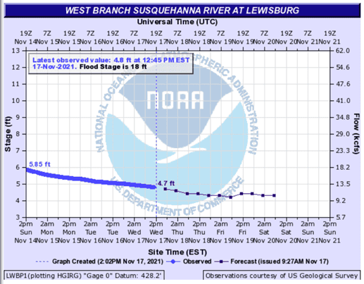
Is there somewhere I can look to find future gage height?
Yes! The National Oceanic and Atmospheric Administration (NOAA) also offers a river gage tool at water.weather.gov that can predict future water levels. Just use the map tool to find your nearest location and open your area’s graph. The graph will illustrate the river’s current water level, the levels measured over the past three days, and the predicted levels of the next three days to come.
Now that you are equipped with the knowledge of understanding your river gage, you can check water levels at any time to prep for your next adventure. Knowing how high your river levels are in your area or when you are traveling to a new paddling site will save you time and keep you safe. Happy paddling!
For more helpful tips when gearing up to paddle, visit our Quick Guide to Paddling the Susquehanna or Paddling Safety Resources.