


At a Glance
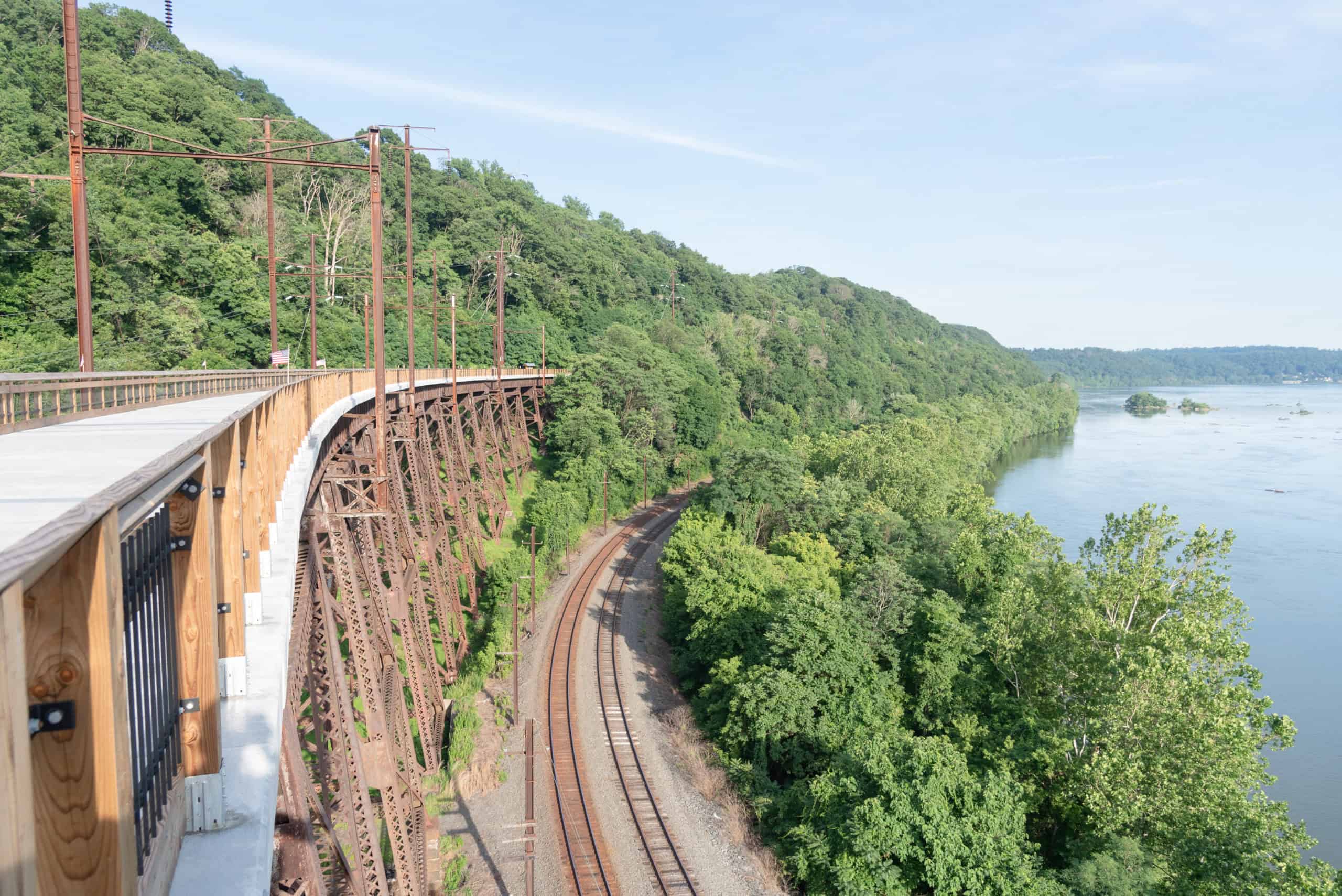
Extending 29 miles, this former railroad bed has transformed into a scenic, crushed-stone trail perfect for leisurely rides and long-distance adventures alike. It begins in Manor Township and hugs the Susquehanna River for about seven picturesque miles before winding inland along a quiet treelined path all the way to Atglen Borough. One of the trail’s most unforgettable features is the Safe Harbor Trestle, where riders are treated to sweeping, 150-foot-high views over the Susquehanna.
Description
The Enola Low-Grade Trail (formerly the Atglen-Susquehanna Trail) stretches about 29 miles from Conestoga, PA, running along the Susquehanna River, curving inland at Safe Harbor, PA, and stretching all the way to Atglen, PA in southeastern Pennsylvania. It follows an abandoned right-of-way of the old Atglen and Susquehanna Branch, one of several branch lines of the Pennsylvania Railroad that linked Atglen with the Harrisburg area.
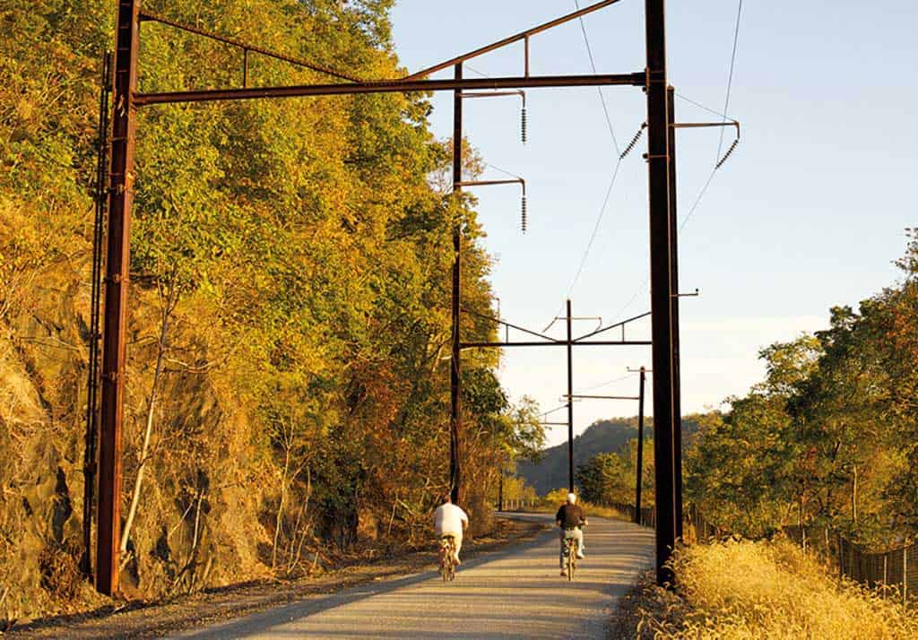
The trail runs through several townships and each manages its own section, so trail conditions may vary among them. In some places there is heavy ballast where wide tires are recommended if you’re biking. In other places the trail has been improved with crushed limestone.
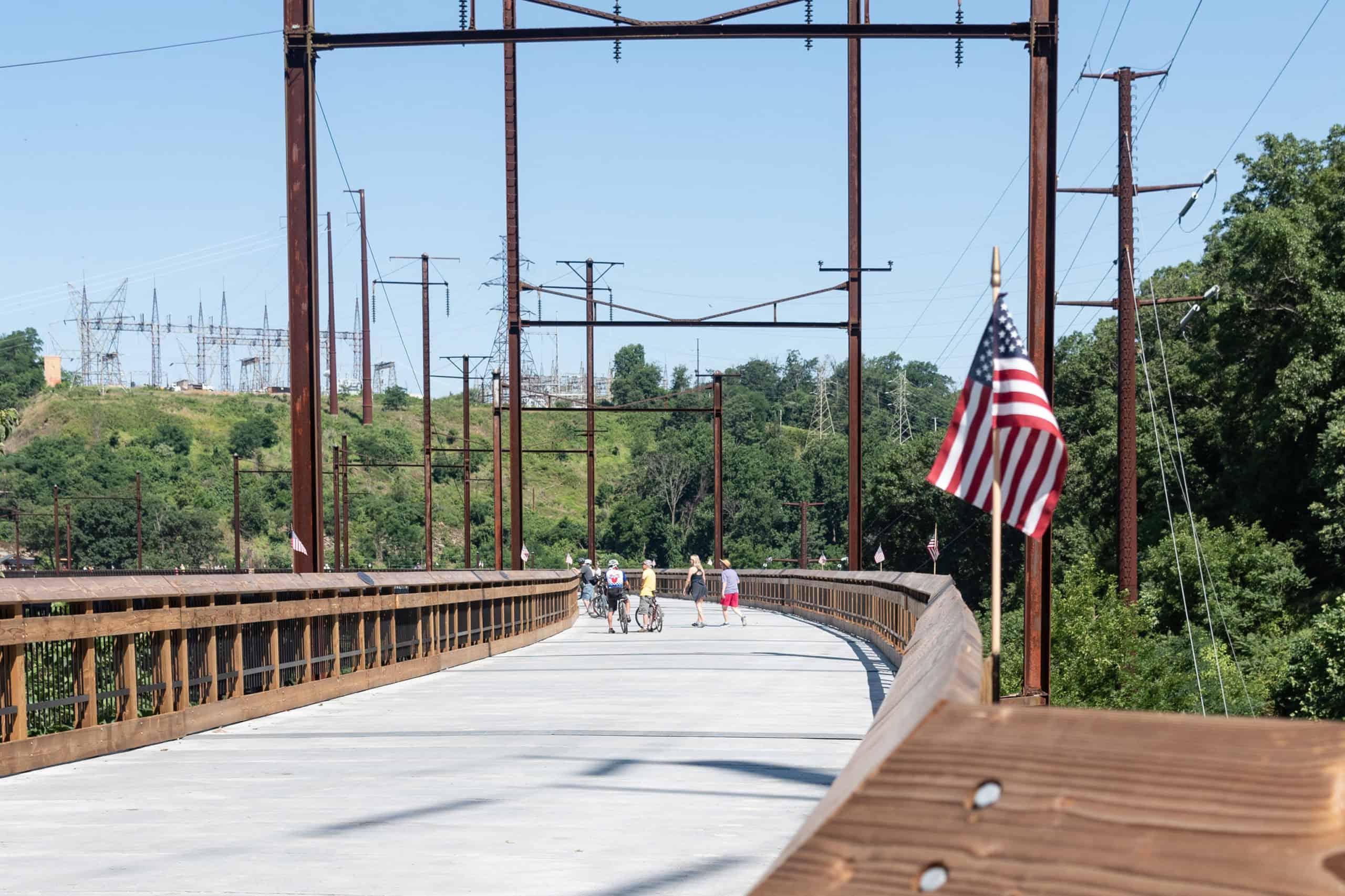
The section that runs along the Susquehanna River is a beauty with towering cliffs on one side and river vistas on the other. It extends the trail 5.25 miles further west following the Susquehanna from an old railroad trestle over the Conestoga River to Manor Township. The Safe Harbor Trestle Bridge opened in summer 2022 as a pedestrian crossing, linking two major pieces of the trail into a continuous 29-mile stretch.
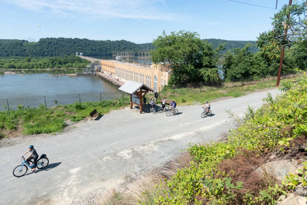
Photo by Mark Kissinger
Parking and Trail Access
Parking is available at many points along the trail, listed here west to east:
- Manor Township: The Turkey Hill Trailhead has spaces for about 60 cars is accessible from Route 441 / River Road.
- Conestoga Township: Parking and an informational kiosk are available at the end of Colemanville Church Road (north of the trail).
- Martic Township: At the intersection of State Route 324 (Marticville Road) and Red Hill Road
- Providence Township (4): Small gravel lot off of Sigman Road, gravel pull-off on Hollow Road, and two lots along Fairview Road.
- Eden Township: Parking lot off Bushong Road.
- Quarryville: Trailheads with parking are available at Fairview Road and Georgetown Road.
-
PLEASE NOTE: If access is not noted here or on the map below, it is likely not a trailhead. Some parts of the trail may appear accessible from Google Maps, but those indicated here are the only official access points. The nearest accesses to the Safe Harbor Bridge are the Turkey Hill Trailhead and the Coleman Church Road Access.
-
Maps
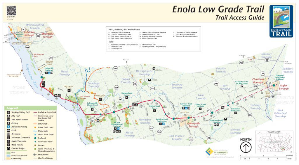
Click here to download a pdf version of this map – Enola Low Grade Map pdf.